| P number: | P006233 |
|---|---|
| Old photograph number: | L00498 |
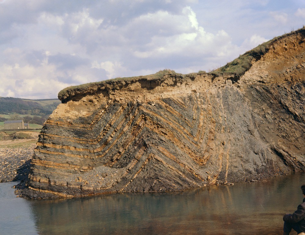
| Caption: | Near Rowlee Bridge, c.800 yd. ESE of junction of rivers Ashop and Alport. |
| Description: | Near Rowlee Bridge, c.800 yd. ESE of junction of rivers Ashop and Alport. Valley-bulge folds in uppermost (R1C) Edale Shales, overlain by a thin layer of head deposits. |
| Date taken: | Sat Oct 01 00:00:00 BST 1966 |
| Photographer: | Dobson, C. |
| Copyright statement: | NERC |
| Acknowledgment: | This image was digitized with grant-in-aid from JIDI the JISC Image Digitization Initiative |
| X longitude/easting: | 414750 |
| Y latitude/northing: | 389150 |
| Coordinate reference system, ESPG code: | 27700 (OSGB 1936 / British National Grid) |
| Orientation: | Landscape |
| Size: | 292.71 KB; 1000 x 772 pixels; 85 x 65 mm (print at 300 DPI); 265 x 204 mm (screen at 96 DPI); |
| Average Rating: | Not yet rated |
| Categories: | Best of BGS Images/ Geological structures |
Loading...
Loading...
Reviews
There is currently no feedback