| P number: | P204228 |
|---|---|
| Old photograph number: | A04280 |
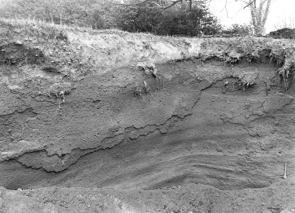
| Caption: | Pit N. of road to Whittington, 0.125 m. N. of mill, Syreford. Looking SE. |
| Description: | Pit N. of road to Whittington, 0.125 m. N. of mill, Syreford. Looking SE. Sludge gravel or 'Coombe Deposit'. Small limestone fragments in a matrix of comminuted limestone, situated on a hill and showing lines of flow down the slope. |
| Date taken: | Tue May 01 00:00:00 BST 1928 |
| Photographer: | Rhodes, J. |
| Copyright statement: | Crown |
| X longitude/easting: | 402500 |
| Y latitude/northing: | 220500 |
| Coordinate reference system, ESPG code: | 27700 (OSGB 1936 / British National Grid) |
| Orientation: | Landscape |
| Size: | 371.32 KB; 1000 x 722 pixels; 85 x 61 mm (print at 300 DPI); 265 x 191 mm (screen at 96 DPI); |
| Average Rating: | Not yet rated |
| Categories: | Unsorted Images, Geoscience subjects/ Landforms, weathering/ Soil and hill creep |
Loading...
Loading...
Reviews
There is currently no feedback