| P number: | P204209 |
|---|---|
| Old photograph number: | A04261 |
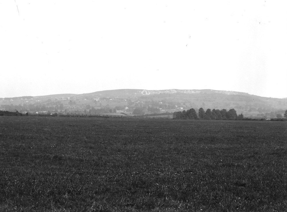
| Caption: | Viewpoint, in field, about 1 m. S. of Bishop's Cleeve. Looking ESE. |
| Description: | Viewpoint, in field, about 1 m. S. of Bishop's Cleeve. Looking ESE. Cleeve Cloud, the highest point (1,070 ft.) of the Cotswolds. The rock capping the hill is Inferior Oolite. The wooded slopes consist of Upper, Middle and Lower Lias. The exposure along the brow of the hill is due partly to quarrying and partly to slipping of the limestone down the clay slopes. |
| Date taken: | Tue May 01 00:00:00 BST 1928 |
| Photographer: | Rhodes, J. |
| Copyright statement: | Crown |
| X longitude/easting: | 395500 |
| Y latitude/northing: | 226500 |
| Coordinate reference system, ESPG code: | 27700 (OSGB 1936 / British National Grid) |
| Orientation: | Landscape |
| Size: | 164.41 KB; 1000 x 739 pixels; 85 x 63 mm (print at 300 DPI); 265 x 196 mm (screen at 96 DPI); |
| Average Rating: | Not yet rated |
| Categories: | Unsorted Images, Geoscience subjects/ General views/ Limestone country |
Loading...
Loading...
Reviews
There is currently no feedback