| P number: | P946954 |
|---|---|
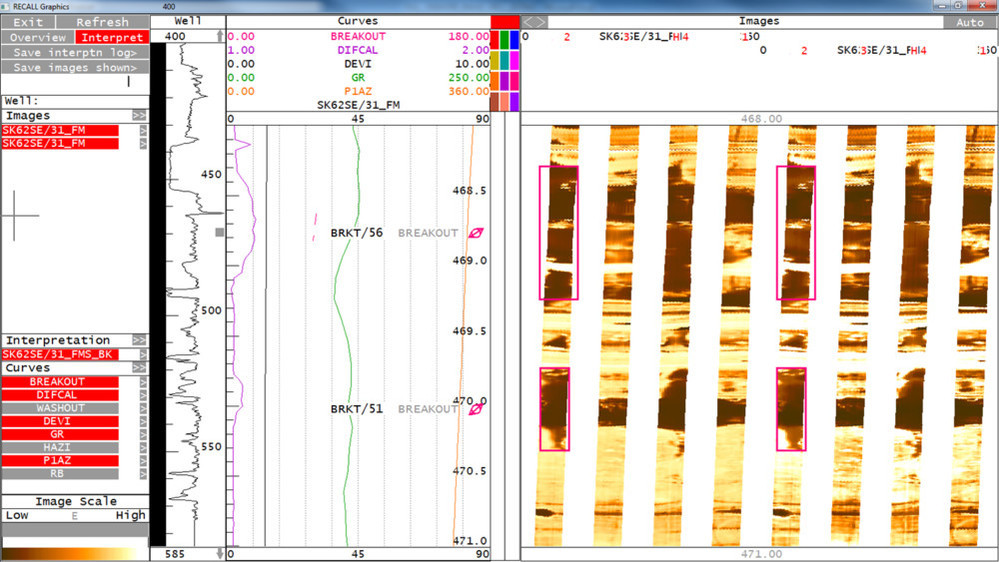
| Caption: | Borehole Breakouts at 468.77 Metres (MD) in the The Saltway Coal Authority Borehole recorded on an FMS borehole imaging tool |
| Description: | MD is measured depth below Rotary Table / Kelly Bushing, The images provided are screen grabs from the IMAGE DISPLAY module in the Landmark RECALL software |
| Date taken: | Tue Mar 01 00:00:00 GMT 2016 |
| Photographer: | Fellgett, M.W. |
| Copyright statement: | NERC |
| X longitude/easting: | 467486 |
| Y latitude/northing: | 321696 |
| Coordinate reference system, ESPG code: | 27700 (OSGB 1936 / British National Grid) |
| Orientation: | Landscape |
| Size: | 175.55 KB; 999 x 562 pixels; 85 x 48 mm (print at 300 DPI); 264 x 149 mm (screen at 96 DPI); |
| Average Rating: | Not yet rated |
| Categories: | Unsorted Images |
Loading...
Loading...
Reviews
There is currently no feedback