| P number: | P204074 |
|---|---|
| Old photograph number: | A04126 |
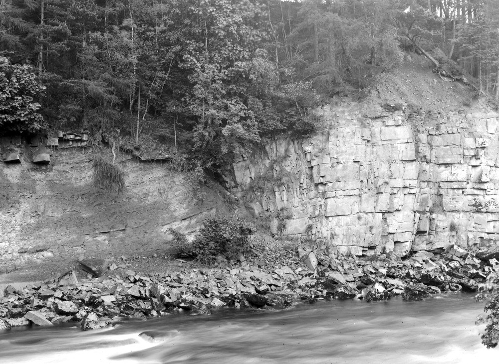
| Caption: | South Tyne (N. bank) 130 yd. above Barhaugh Burn outfall, about 1 1/4 m. SE of Slaggyford Station. Looking SE. |
| Description: | South Tyne (N. bank) 130 yd. above Barhaugh Burn outfall, about 1 1/4 m. SE of Slaggyford Station. Looking SE. Fault in the Carboniferous Limestone Series. This fault is the northern of two which form a small trough, letting down the Nattrass Gill Hazle (Middle Limestone Group) on the right to the level of the shale below it (left). |
| Date taken: | Wed Jun 01 00:00:00 BST 1927 |
| Photographer: | Rhodes, J. |
| Copyright statement: | Crown |
| X longitude/easting: | 369045 |
| Y latitude/northing: | 551251 |
| Coordinate reference system, ESPG code: | 27700 (OSGB 1936 / British National Grid) |
| Orientation: | Landscape |
| Size: | 317.76 KB; 1000 x 731 pixels; 85 x 62 mm (print at 300 DPI); 265 x 193 mm (screen at 96 DPI); |
| Average Rating: | Not yet rated |
| Categories: | Unsorted Images, Geoscience subjects/ Structural features/ Fault breccia |
Loading...
Loading...
Reviews
There is currently no feedback