| P number: | P204059 |
|---|---|
| Old photograph number: | A04111 |
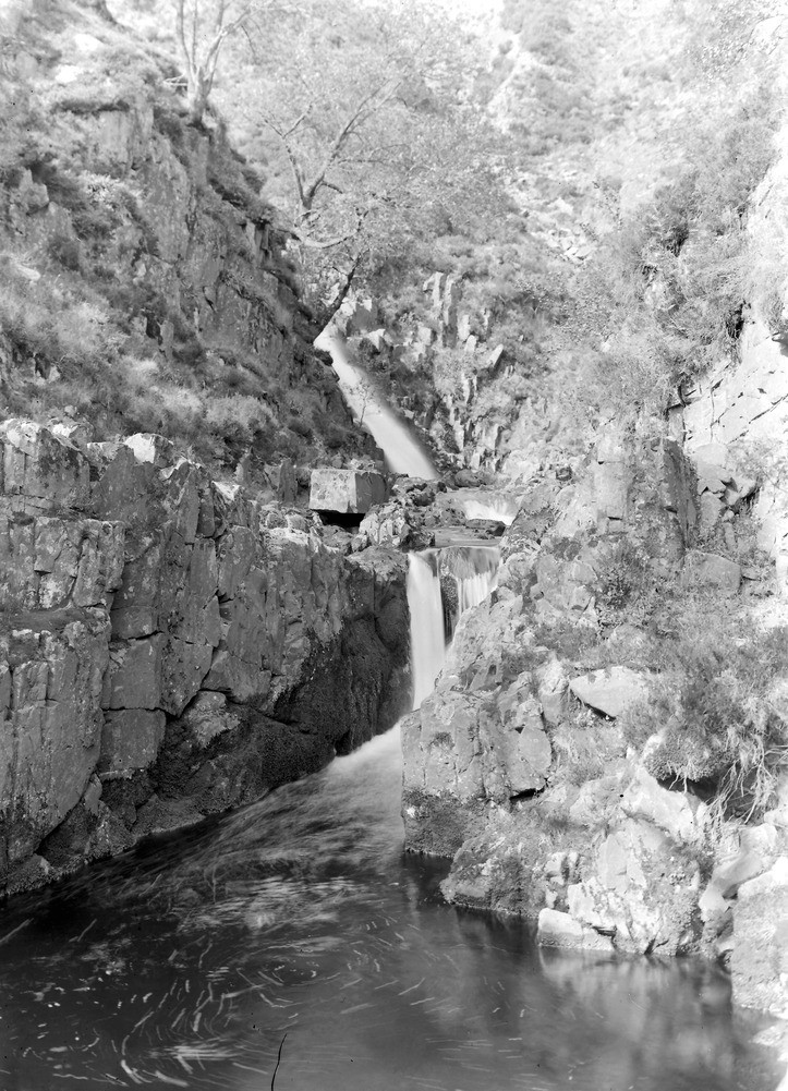
| Caption: | Black Burn, about 1 1/2 m. SSW of Midgeholme. Looking SE. |
| Description: | Black Burn, about 1 1/2 m. SSW of Midgeholme. Looking SE. Waterfalls over Whin Sill intruded into Carboniferous Limestone Series. The jointed character of the rock is seen on the right, above a deep pool which has been formed at the foot of the lower waterfall. |
| Date taken: | Wed Jun 01 00:00:00 BST 1927 |
| Photographer: | Rhodes, J. |
| Copyright statement: | Crown |
| X longitude/easting: | 362464 |
| Y latitude/northing: | 557545 |
| Coordinate reference system, ESPG code: | 27700 (OSGB 1936 / British National Grid) |
| Orientation: | Portrait |
| Size: | 289.65 KB; 723 x 1001 pixels; 61 x 85 mm (print at 300 DPI); 191 x 265 mm (screen at 96 DPI); |
| Average Rating: | Not yet rated |
| Categories: | Unsorted Images, Geoscience subjects/ Igneous features/ Sills, Geoscience subjects/ Landforms, river/ Waterfalls and pot-holes |
Loading...
Loading...
Reviews
There is currently no feedback