| P number: | P204056 |
|---|---|
| Old photograph number: | A04108 |
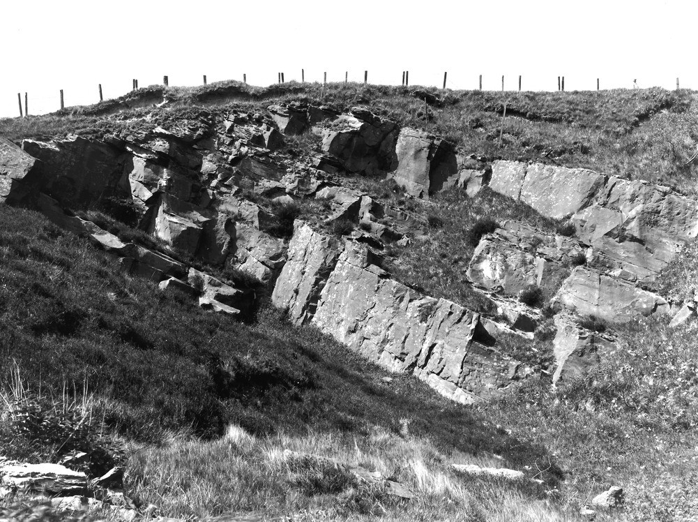
| Caption: | Quarry 50 yd. N. of Roachburn Colliery, 2 1/4 m. E. of Hallbank Gate. Looking N. |
| Description: | Quarry 50 yd. N. of Roachburn Colliery, 2 1/4 m. E. of Hallbank Gate. Looking N. The Firestone Sill (Carboniferous Limestone Series). The rock, here dipping eastward at 30 degrees, shows the posts of massive sandstone typical of the sill. |
| Date taken: | Wed Jun 01 00:00:00 BST 1927 |
| Photographer: | Rhodes, J. |
| Copyright statement: | Crown |
| X longitude/easting: | 361557 |
| Y latitude/northing: | 559778 |
| Coordinate reference system, ESPG code: | 27700 (OSGB 1936 / British National Grid) |
| Orientation: | Landscape |
| Size: | 339.17 KB; 1001 x 748 pixels; 85 x 63 mm (print at 300 DPI); 265 x 198 mm (screen at 96 DPI); |
| Average Rating: | Not yet rated |
| Categories: | Unsorted Images, Geoscience subjects/ Landforms, river/ Flood-plains and alluvial flats |
Loading...
Loading...
Reviews
There is currently no feedback