| P number: | P204036 |
|---|---|
| Old photograph number: | A04088 |
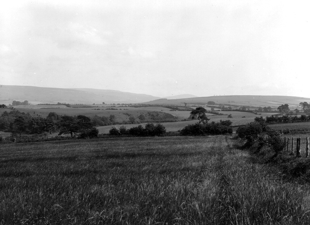
| Caption: | In field about 1/2 m. SW of Hallfields, about 3/4 m. SSE of Cumwhitton. Looking NE-SE. |
| Description: | In field about 1/2 m. SW of Hallfields, about 3/4 m. SSE of Cumwhitton. Looking NE-SE. Panoramic view of solid and glacial features about Cumwhitton and Cumrew. Right half A4088. In the middle distance is a continuation of the gravel delta. On the right behind the gravel rises the high ground (700-800 ft) of the St. Bees Sandstone escarpment, the St. Bees shales forming the lower westerly slopes. In the distance rises the Melmerby Scar Limestone escarpment, with Newbiggin Fell behind and in the extreme distance the hill of Thack Moor (Sheet 24). |
| Date taken: | Wed Jun 01 00:00:00 BST 1927 |
| Photographer: | Rhodes, J. |
| Copyright statement: | Crown |
| X longitude/easting: | 351374 |
| Y latitude/northing: | 551345 |
| Coordinate reference system, ESPG code: | 27700 (OSGB 1936 / British National Grid) |
| Orientation: | Landscape |
| Size: | 202.01 KB; 1000 x 728 pixels; 85 x 62 mm (print at 300 DPI); 265 x 193 mm (screen at 96 DPI); |
| Average Rating: | Not yet rated |
| Categories: | Unsorted Images |
Loading...
Loading...
Reviews
There is currently no feedback