| P number: | P204024 |
|---|---|
| Old photograph number: | A04076 |
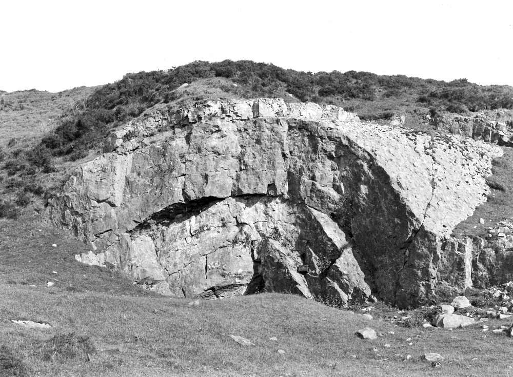
| Caption: | Quarry, 750 yd. NE of Tottergill, about 3/4 m. ESE of Castle Carrock. Looking S. |
| Description: | Quarry, 750 yd. NE of Tottergill, about 3/4 m. ESE of Castle Carrock. Looking S. Anticlinal fold in (?) Four Fathom Limestone (Carboniferous Limestone Series). This fold is one of the group of folds which characterize the north-western marginal areas of the fault-block of the Northern Pennines. |
| Date taken: | Wed Jun 01 00:00:00 BST 1927 |
| Photographer: | Rhodes, J. |
| Copyright statement: | Crown |
| X longitude/easting: | 355404 |
| Y latitude/northing: | 554889 |
| Coordinate reference system, ESPG code: | 27700 (OSGB 1936 / British National Grid) |
| Orientation: | Landscape |
| Size: | 333.12 KB; 1000 x 735 pixels; 85 x 62 mm (print at 300 DPI); 265 x 194 mm (screen at 96 DPI); |
| Average Rating: | Not yet rated |
| Categories: | Unsorted Images, Geoscience subjects/ Structural features/ Folding |
Loading...
Loading...
Reviews
There is currently no feedback