| P number: | P203994 |
|---|---|
| Old photograph number: | A04046 |
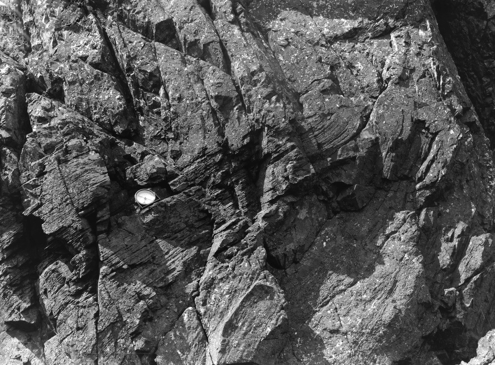
| Caption: | Crag, 1 furlong S.W of trig point 1720 on Gavel Fell. Looking NE. |
| Description: | Crag, 1 furlong S.W of trig point 1720 on Gavel Fell. Looking NE. Sharply-folded Blake Fell Mudstones (Skiddaw Slates). A sharp overfold, the north-west limb supporting the compass, the south-east limb (lower and right part of view) inverted to 100 degrees - 115 degrees. The mudstones are hard and weather rough; the hardening is later than the folding. |
| Date taken: | Wed Jun 01 00:00:00 BST 1927 |
| Photographer: | Rhodes, J. |
| Copyright statement: | Crown |
| X longitude/easting: | 311526 |
| Y latitude/northing: | 518285 |
| Coordinate reference system, ESPG code: | 27700 (OSGB 1936 / British National Grid) |
| Orientation: | Landscape |
| Size: | 361.67 KB; 1000 x 737 pixels; 85 x 62 mm (print at 300 DPI); 265 x 195 mm (screen at 96 DPI); |
| Average Rating: | Not yet rated |
| Categories: | Unsorted Images, Geoscience subjects/ Structural features/ Folding |
Loading...
Loading...
Reviews
There is currently no feedback