| P number: | P203980 |
|---|---|
| Old photograph number: | A04032 |
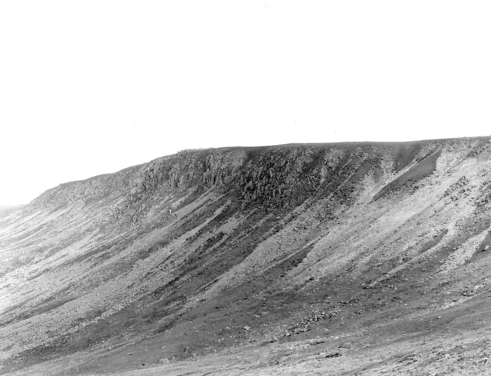
| Caption: | 1/2 m. ENE of trig point 2188 on Caw Fell, 71/2 m. E. of Egremont. Looking SE. |
| Description: | 1/2 m. ENE of trig point 2188 on Caw Fell, 71/2 m. E. of Egremont. Looking SE. Screes and crags of granophyre at head of Silver Cove Beck Valley. The scree reaching to the top of the slope on the right is of brecciated granophyre from a wide N.-S. crush-belt. Less affected granophyre forms crags in the centre and left of the view. The whole forms the head of Silvercove Beck - the western arm of Deep Gill, and is in part the result of corrie erosion. |
| Date taken: | Sun May 01 00:00:00 BST 1927 |
| Photographer: | Rhodes, J. |
| Copyright statement: | Crown |
| X longitude/easting: | 312565 |
| Y latitude/northing: | 511557 |
| Coordinate reference system, ESPG code: | 27700 (OSGB 1936 / British National Grid) |
| Orientation: | Landscape |
| Size: | 229.08 KB; 1000 x 765 pixels; 85 x 65 mm (print at 300 DPI); 265 x 202 mm (screen at 96 DPI); |
| Average Rating: | Not yet rated |
| Categories: | Unsorted Images, Geoscience subjects/ Landforms, weathering/ Screes and talus |
Loading...
Loading...
Reviews
There is currently no feedback