| P number: | P203902 |
|---|---|
| Old photograph number: | A03954 |
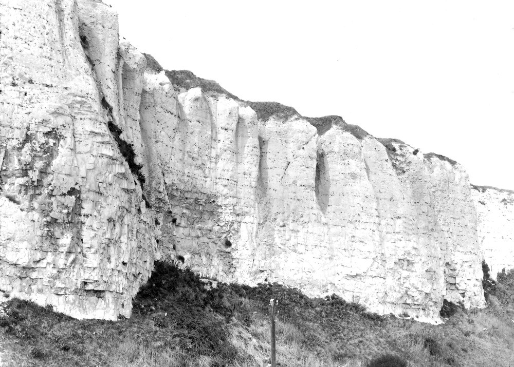
| Caption: | Kingsdown, S. of Walmer (at Rifle Range, N. end), near Oldstairs Gap. Looking NW. |
| Description: | Kingsdown, S. of Walmer (at Rifle Range, N. end), near Oldstairs Gap. Looking NW. Upper Chalk cliff. Another view of cliff shown in A3953. [Upper Chalk. Chalk of upper part of Micraster coranguinum Zone, showing grooves developed by weathering along vertical joints. This piece of cliff is seen near middle of No. A3949.] |
| Date taken: | Fri Apr 01 00:00:00 GMT 1927 |
| Photographer: | Rhodes, J. |
| Copyright statement: | Crown |
| X longitude/easting: | 638500 |
| Y latitude/northing: | 147500 |
| Coordinate reference system, ESPG code: | 27700 (OSGB 1936 / British National Grid) |
| Orientation: | Landscape |
| Size: | 261.51 KB; 1000 x 715 pixels; 85 x 61 mm (print at 300 DPI); 265 x 189 mm (screen at 96 DPI); |
| Average Rating: | Not yet rated |
| Categories: | Unsorted Images, Geoscience subjects/ Landforms, weathering/ Weathering along bedding. Joints, cleavage |
Loading...
Loading...
Reviews
There is currently no feedback