| P number: | P203625 |
|---|---|
| Old photograph number: | A03677 |
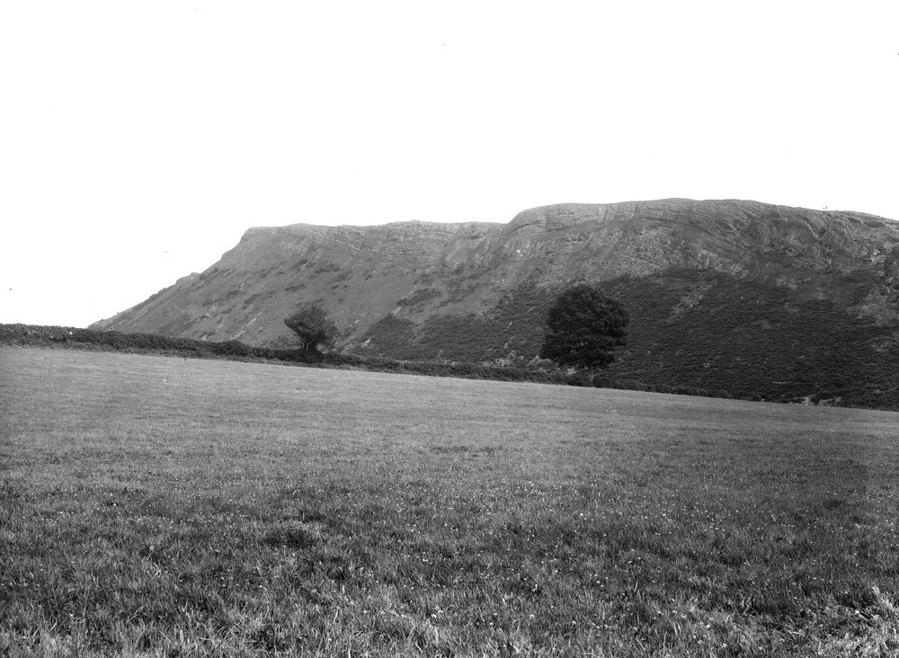
| Caption: | Craig-Orllwyn, about 1 m. N. of Pentre-felin Station. Looking E. |
| Description: | Craig-Orllwyn, about 1 m. N. of Pentre-felin Station. Looking E. Cwmclwyd Ash, Craig-Orllwyn, 2 miles east of Llanrhaiadr-ym-Mochnant. The crag overstepping the steep slope is formed by the Cwmclwyd Ash, which dips south-eastward. It overlies Llandeilo Beds (Mynydd-Tarw Group) and itself forms the base of the Caradocian Series. The near end of the crag terminates against the Craig-y-glyn Fault. The two rounded hills (The Arans) on the skyline (centre and right-centre) are Caradocian shales stiffened by thin beds of sandstone. Lower part of the ash, interbedded with shales, overtopping the poorly-cleaved Llandeilo Shales (Mynydd-Tarw Beds). Boulder clay in foreground. |
| Date taken: | Wed Sep 01 00:00:00 BST 1926 |
| Photographer: | Rhodes, J. |
| Copyright statement: | Crown |
| X longitude/easting: | 316500 |
| Y latitude/northing: | 326500 |
| Coordinate reference system, ESPG code: | 27700 (OSGB 1936 / British National Grid) |
| Orientation: | Landscape |
| Size: | 221.86 KB; 1000 x 732 pixels; 85 x 62 mm (print at 300 DPI); 265 x 194 mm (screen at 96 DPI); |
| Average Rating: | Not yet rated |
| Categories: | Unsorted Images |
Loading...
Loading...
Reviews
There is currently no feedback