| P number: | P005818 |
|---|---|
| Old photograph number: | A12571 |
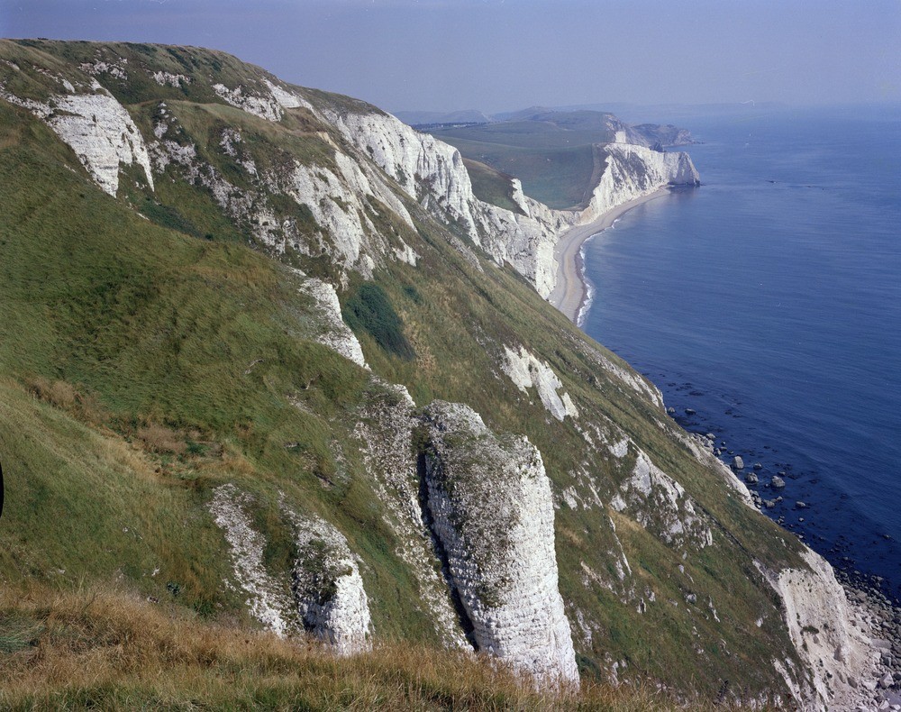
| Caption: | White Nothe. Looking E. |
| Description: | White Nothe. Looking E. Coast east of White Nothe, Dorset. View looking east along foresyncline and steep middle limb of the Purbeck anticline, from east of White Nothe. In the foreground Upper Chalk with bands of flint dipping gently south (seaward) towards Middle Bottom, which coincides with the foresyncline, in the centre of the picture. In the cliff beyond, the Micraster Zones rise in a steeply increasing curve until at the first headland, Bat's Head, they and the Planus Zone are vertical. The vertical hardened chalk forms the high ridge which strikes half left into the distance. The second headland is Dungy Head, of Portland Stone dipping about 45 degrees north. In the distance is the plateau of Purbeck, where the Portland and Purbeck Beds lie nearly flat on the axis of the anticline. The farthest point on the horizon is St. Alban's Head. |
| Date taken: | Sat Jan 01 00:00:00 GMT 1977 |
| Photographer: | Evans, H.J. |
| Copyright statement: | NERC |
| Acknowledgment: | This image was digitized with grant-in-aid from JIDI the JISC Image Digitization Initiative |
| X longitude/easting: | 377400 |
| Y latitude/northing: | 80700 |
| Coordinate reference system, ESPG code: | 27700 (OSGB 1936 / British National Grid) |
| Orientation: | Landscape |
| Size: | 316.55 KB; 1000 x 790 pixels; 85 x 67 mm (print at 300 DPI); 265 x 209 mm (screen at 96 DPI); |
| Average Rating: | Not yet rated |
| Categories: | Unsorted Images, Geoscience subjects/ Landforms, marine/ Cliffs |
Loading...
Loading...
Reviews
There is currently no feedback