| P number: | P005798 |
|---|---|
| Old photograph number: | A12221 |
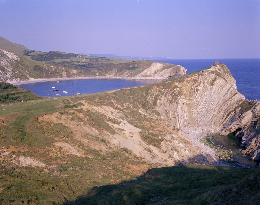
| Caption: | Lulworth Cove. Looking E. |
| Description: | Lulworth Cove. Looking E. Lulworth Cove - a natural harbour. The cove has been formed by widening of the sea in the Portland Stone and Lower Purbeck Limestone, and by washing away of the softer Middle and Upper Purbeck and Wealdon Beds behind. On the far side are seen in order from left to right: Chalk. Upper Greensand and Gault. Wealdon Beds vertical in the centre and Upper and Middle Purbeck Beds to the right. In the Stair Hole Cove (on the right) are seen contorted Middle Purbeck clays and limestones. |
| Date taken: | Tue Jan 01 00:00:00 GMT 1974 |
| Photographer: | Pulsford, J.M. |
| Copyright statement: | NERC |
| Acknowledgment: | This image was digitized with grant-in-aid from JIDI the JISC Image Digitization Initiative |
| X longitude/easting: | 382200 |
| Y latitude/northing: | 79900 |
| Coordinate reference system, ESPG code: | 27700 (OSGB 1936 / British National Grid) |
| Orientation: | Landscape |
| Size: | 242.81 KB; 1000 x 791 pixels; 85 x 67 mm (print at 300 DPI); 265 x 209 mm (screen at 96 DPI); |
| Average Rating: | Not yet rated |
| Categories: | Unsorted Images, Geoscience subjects/ Landforms, marine/ Coastal scenery, general views, Geoscience subjects/ Named locality |
Loading...
Loading...
Reviews
There is currently no feedback