| P number: | P005505 |
|---|---|
| Old photograph number: | L02079 |
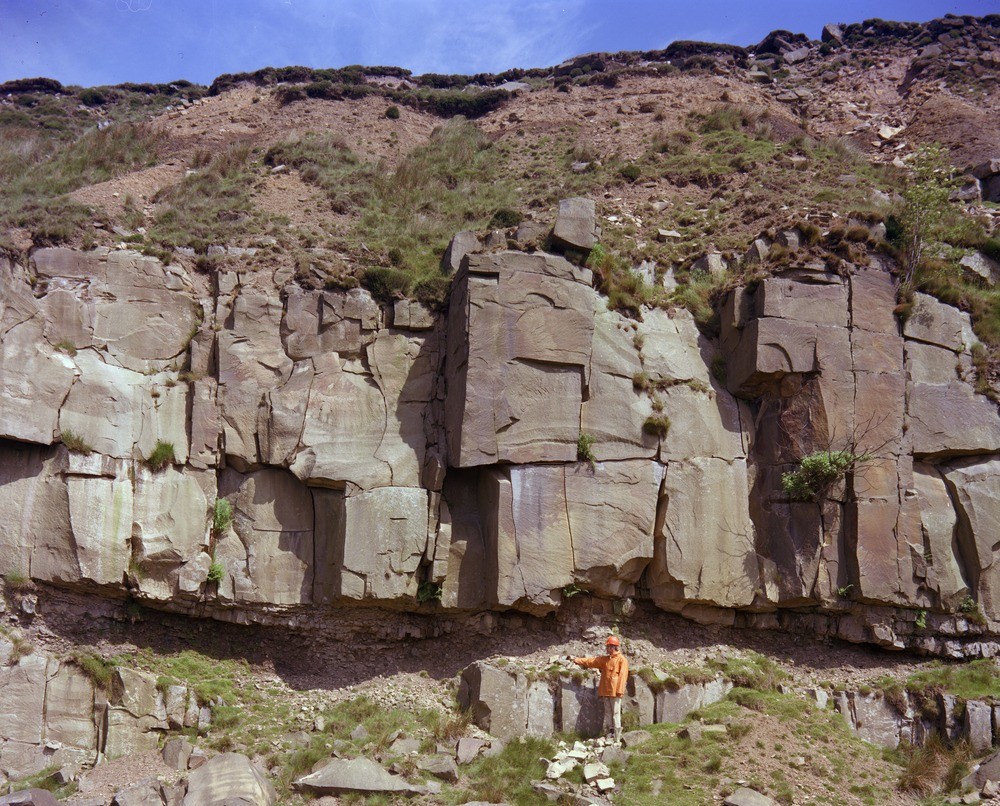
| Caption: | Carle Fell Quarries (upper level) Upper Nidderdale. Looking N. |
| Description: | Carle Fell Quarries (upper level) Upper Nidderdale. Looking N. The arm of the observer points at the base of a channel filled with soft sandstone with very abundant mudstone clasts, forming the undercut portion of the cliff. The thickly-bedded sandstone is the highest seen in the Scar House beds (Namurian, E2) hereabouts. The highest slopes are in weathered silty mudstones which underlie the Lower Follifoot Grit (not visible in photo). (See also close-up of this view.) |
| Date taken: | Sat May 01 00:00:00 BST 1976 |
| Photographer: | Thornton, K.E. |
| Copyright statement: | NERC |
| Acknowledgment: | This image was digitized with grant-in-aid from JIDI the JISC Image Digitization Initiative |
| X longitude/easting: | 406230 |
| Y latitude/northing: | 477670 |
| Coordinate reference system, ESPG code: | 27700 (OSGB 1936 / British National Grid) |
| Orientation: | Landscape |
| Size: | 340.81 KB; 1000 x 806 pixels; 85 x 68 mm (print at 300 DPI); 265 x 213 mm (screen at 96 DPI); |
| Average Rating: | Not yet rated |
| Categories: | Unsorted Images, Geoscience subjects/ Rocks, sedimentary/ Sandstone |
Loading...
Loading...
Reviews
There is currently no feedback