| P number: | P005496 |
|---|---|
| Old photograph number: | L02070 |
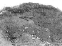
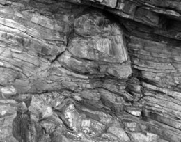
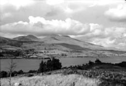
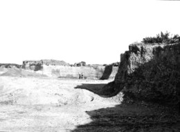
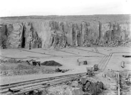
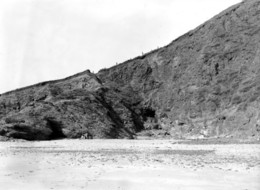
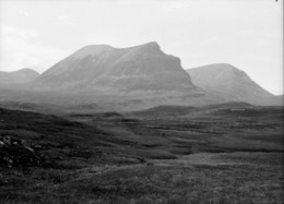
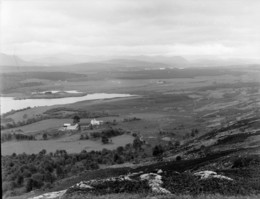
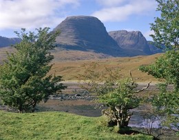
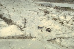
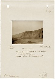
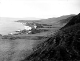
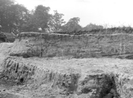
| Caption: | Scar House Gill, Upper Nidderdale. Looking N. |
| Description: | Scar House Gill, Upper Nidderdale. Looking N. The Red Scar Grit (Namurian, E2), adjacent to the observer, is here unusually full of seatearth mudstone and mudstone partings. Downhill lie typical mudstone cliffs in the Nidderdale Shales (E2). The lower slopes near the Scar House Reservoir are in beds of the Grassington Grit Group (E1). In the distance is Carle Fell capped by Lower Follifoot Grit (H). The distant quarries are in Scar House Beds (E2). |
| Date taken: | Tue Jun 01 00:00:00 BST 1976 |
| Photographer: | Thornton, K.E. |
| Copyright statement: | NERC |
| Acknowledgment: | This image was digitized with grant-in-aid from JIDI the JISC Image Digitization Initiative |
| X longitude/easting: | 406270 |
| Y latitude/northing: | 476190 |
| Coordinate reference system, ESPG code: | 27700 (OSGB 1936 / British National Grid) |
| Orientation: | Landscape |
| Size: | 310.24 KB; 1000 x 808 pixels; 85 x 68 mm (print at 300 DPI); 265 x 214 mm (screen at 96 DPI); |
| Average Rating: | Not yet rated |
| Categories: | Unsorted Images |
Loading...
Loading...
Reviews
There is currently no feedback