| P number: | P005463 |
|---|---|
| Old photograph number: | L00592 |
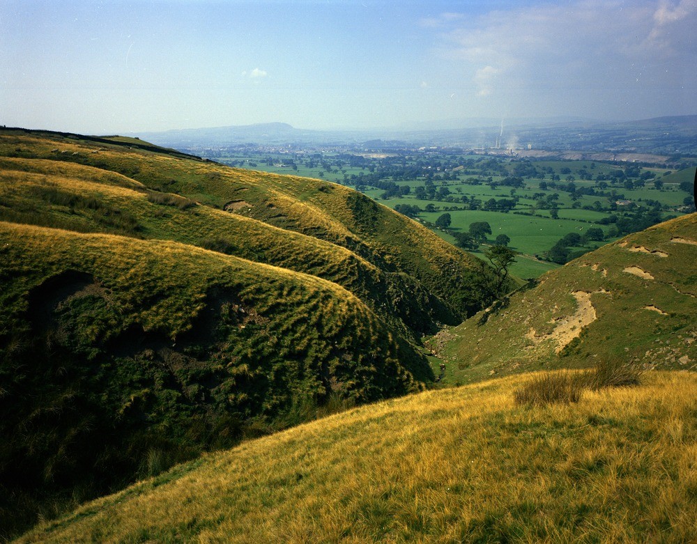
| Caption: | Clitheroe. Looking NW. |
| Description: | Clitheroe. Looking NW. Little Mearley Clough. The deep clough is cut through the Bowland Shale Group, with the contained Pendleside Sandstone; and the Pendleside Limestone; forming the upper part of the Worston Shale Group. The low ground in the middle distance is formed by till-covered Worston Shales, through which rises the long Bellmanpark Knoll quarried in the right near distance. |
| Date taken: | Thu Jan 01 00:00:00 GMT 1970 |
| Photographer: | Baker, P.E. |
| Copyright statement: | NERC |
| Acknowledgment: | This image was digitized with grant-in-aid from JIDI the JISC Image Digitization Initiative |
| X longitude/easting: | 378100 |
| Y latitude/northing: | 441400 |
| Coordinate reference system, ESPG code: | 27700 (OSGB 1936 / British National Grid) |
| Orientation: | Landscape |
| Size: | 290.53 KB; 1000 x 781 pixels; 85 x 66 mm (print at 300 DPI); 265 x 207 mm (screen at 96 DPI); |
| Average Rating: | Not yet rated |
| Categories: | Unsorted Images, Geoscience subjects/ Landforms, river/ Valleys |
Loading...
Loading...
Reviews
There is currently no feedback