| P number: | P005024 |
|---|---|
| Old photograph number: | D03825 |
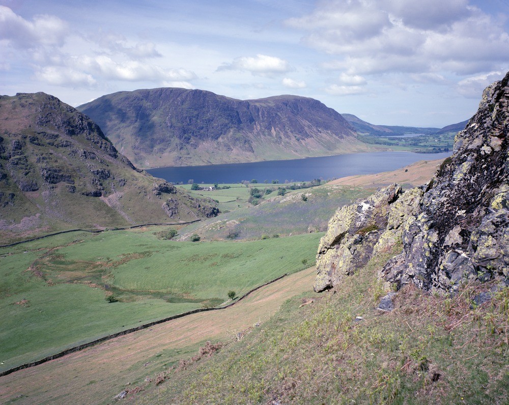
| Caption: | High Rannerdale, Crummock Waler and Mellbreak. Looking NW. |
| Description: | High Rannerdale, Crummock Waler and Mellbreak. Looking NW. Hornfels and tourmaline veins (foreground), Skiddaw Group scenery (background). In the foreground bleached hornfelsed Skiddaw Group siltstones are cut by black tourmaline veins with abundant white quartz veins. Left of the picture is Rannerdale Knotts and on the far side of the lake Mellbreak, both are hornfelsed Skiddaw Group forming part of the Crummock Water Aureole. The main lake is Crummock Water and the small lake Loweswater, both lie in the bottom of glaciated valleys. The two buildings near the lake in the middle of the photograph are on a gently sloping alluvial fan. |
| Date taken: | Thu Jan 01 00:00:00 GMT 1987 |
| Photographer: | Bain, T.S. |
| Copyright statement: | NERC |
| Acknowledgment: | This image was digitized with grant-in-aid from JIDI the JISC Image Digitization Initiative |
| X longitude/easting: | 318960 |
| Y latitude/northing: | 519130 |
| Coordinate reference system, ESPG code: | 27700 (OSGB 1936 / British National Grid) |
| Orientation: | Landscape |
| Size: | 315.21 KB; 1000 x 796 pixels; 85 x 67 mm (print at 300 DPI); 265 x 211 mm (screen at 96 DPI); |
| Average Rating: | Not yet rated |
| Categories: | Best of BGS Images/ Landscapes |
Loading...
Loading...
Reviews
There is currently no feedback