| P number: | P005021 |
|---|---|
| Old photograph number: | D03822 |
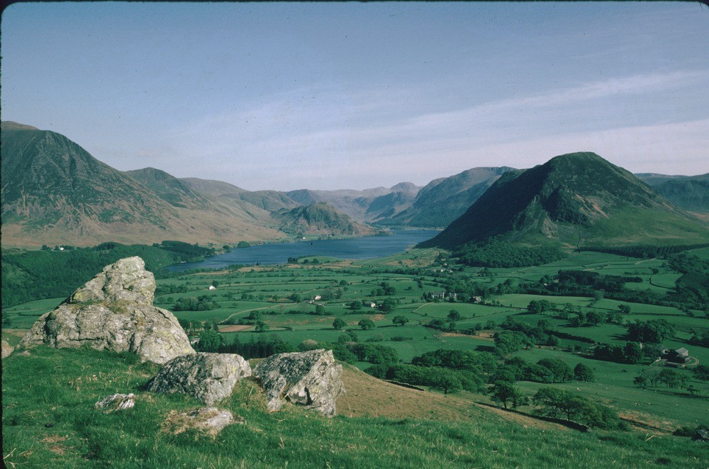
| Caption: | Low Fell, S. flank, Loweswater. View SSE. |
| Description: | Low Fell, S. flank, Loweswater. View SSE. View from Low Fell, Loweswater. The foreground rocks are inverted sandstones in the thrust mass of the Loweswater anticline. The middle ground is Mellbreak and Grasmoor, part of the Crummock Water metamorphic aureole. The distant fells are the Buttermere Formation, Ennerdale Granophyre and Borrowdale Volcanic Group in the far distance. |
| Date taken: | Fri May 01 00:00:00 BST 1987 |
| Photographer: | Bain, T.S. |
| Copyright statement: | NERC |
| Acknowledgment: | This image was digitized with grant-in-aid from JIDI the JISC Image Digitization Initiative |
| X longitude/easting: | 313610 |
| Y latitude/northing: | 521940 |
| Coordinate reference system, ESPG code: | 27700 (OSGB 1936 / British National Grid) |
| Orientation: | Landscape |
| Size: | 200.00 KB; 1000 x 662 pixels; 85 x 56 mm (print at 300 DPI); 265 x 175 mm (screen at 96 DPI); |
| Average Rating: | Not yet rated |
| Categories: | Best of BGS Images/ Landscapes |
Loading...
Loading...
Reviews
There is currently no feedback