| P number: | P002993 |
|---|---|
| Old photograph number: | MNS06053/16 |
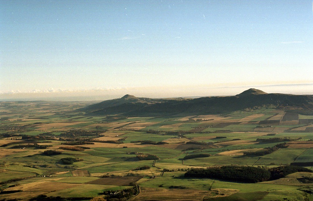
| Caption: | Oblique aerial view looking eastwards towards the Howe of Fife and Lomond Hills, Fife Region. |
| Description: | Oblique aerial view looking eastwards towards the Howe of Fife and Lomond Hills, Fife Region. The Howe of Fife lying between the Ochil Hills and the Lomond Hills forms a marked area of low ground extending nearly 30 miles from Kinross to the sea in St. Andrews Bay. It is underlain by Upper Devonian rocks. The prominent scarp feature in the Lomond Hills is formed from the quartz-dolerite Midland Valley Sill while the two prominent peaks are the eroded remnants of volcanic necks standing above the sill. The igneous rocks of the Lomond Hills are of Carboniferous-Lower Permian age and are intruded into Lower Carboniferous sedimentary rocks. |
| Photographer: | Bain, T.S. |
| Copyright statement: | NERC |
| Acknowledgment: | This image was digitized with grant-in-aid from SCRAN the Scottish Cultural Resources Access Network |
| Orientation: | Landscape |
| Size: | 183.51 KB; 1000 x 642 pixels; 85 x 54 mm (print at 300 DPI); 265 x 170 mm (screen at 96 DPI); |
| Average Rating: | Not yet rated |
| Categories: | Best of BGS Images/ Landscapes |
Loading...
Loading...
Reviews
There is currently no feedback