| P number: | P002986 |
|---|---|
| Old photograph number: | MNS06052/22 |
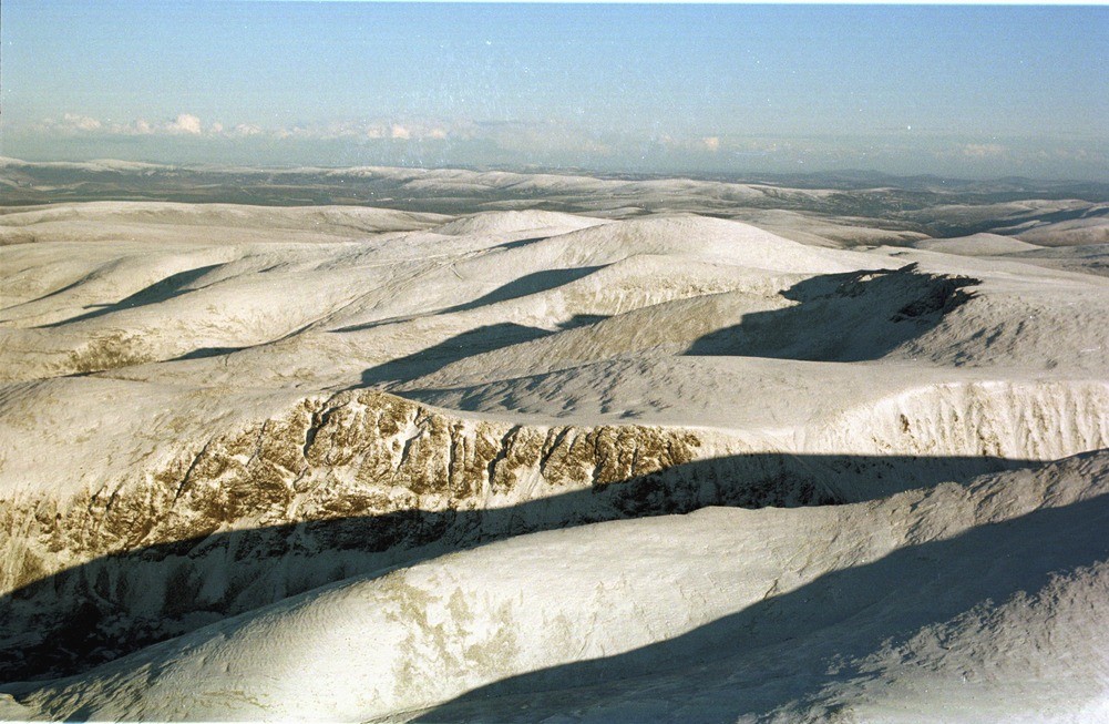
| Caption: | Oblique aerial view of Lairig Ghru and Lurcher's Crag (the prominent crag in the left foreground), Cairngorms, looking east, Inverness-shire. |
| Description: | Lurcher's Crag shows gullying on the upper free faces while below well-developed scree slopes have formed. These slopes and the slopes to the right of the crag have undergone considerable modification by recent avalanches sweeping down from the gullies on the upper slopes entraining talus and reworking debris-flows. The latter are an even more effective method of erosion. They are rapid downslope flows of poorly-sorted material derived from the scree slopes that end in lobes of bouldery debris in the valley floor. The cause is very heavy rainfall. The Cairn Lochan - Cairn Gorm ridge is noted for its outstanding periglacial features. The Lairig Ghru is a 12 km. long glacial breach extending from Rothiemurchus Lodge at its northern end to Glen Geusachan at its southern end. Beyond, the undulating plateau surface of the Cairngorms massif is clearly visible. On the right above the cliffs in shadow is Cairn Lochan (1215 m.), beyond and slightly to the left is the rounded summit of Cairn Gorm (1245 m.). |
| Photographer: | Bain, T.S. |
| Copyright statement: | NERC |
| Acknowledgment: | This image was digitized with grant-in-aid from SCRAN the Scottish Cultural Resources Access Network |
| Orientation: | Landscape |
| Size: | 233.22 KB; 1001 x 653 pixels; 85 x 55 mm (print at 300 DPI); 265 x 173 mm (screen at 96 DPI); |
| Average Rating: | Not yet rated |
| Categories: | Best of BGS Images/ Landscapes |
Loading...
Loading...
Reviews
There is currently no feedback