| P number: | P002968 |
|---|---|
| Old photograph number: | MNS05138 |
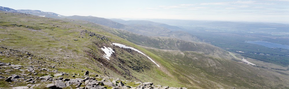
| Caption: | Panoramic view from summit of Cairngorm looking south-west towards Cairn Toul, Braeriach, Lurcher's Crag, Cairn Lochan and Coire an t-Sneachda, Inverness-shire. |
| Description: | Panoramic view from summit of Cairngorm looking south-west towards Cairn Toul, Braeriach, Lurcher's Crag, Cairn Lochan and Coire an t-Sneachda, Inverness-shire. The Cairngorm plateau forms the largest single area of land in the British Isles over 900 m. Because of their height and position the Cairngorms have close to an arctic climate. The tops are part of an ancient pre-glacial surface now deeply eroded by successive glaciations. The dominant landforms of this glacial erosion are the deep glacial troughs and the high-level corries. |
| Date taken: | Sun Jan 01 00:00:00 GMT 1989 |
| Photographer: | Unknown |
| Copyright statement: | Unknown |
| Acknowledgment: | This image was digitized with grant-in-aid from SCRAN the Scottish Cultural Resources Access Network |
| X longitude/easting: | 300440 |
| Y latitude/northing: | 804320 |
| Coordinate reference system, ESPG code: | 27700 (OSGB 1936 / British National Grid) |
| Orientation: | Landscape |
| Size: | 114.89 KB; 1000 x 309 pixels; 85 x 26 mm (print at 300 DPI); 265 x 82 mm (screen at 96 DPI); |
| Average Rating: | Not yet rated |
| Categories: | Best of BGS Images/ Landscapes |
Loading...
Loading...
Reviews
There is currently no feedback