| P number: | P002922 |
|---|---|
| Old photograph number: | D05307 |
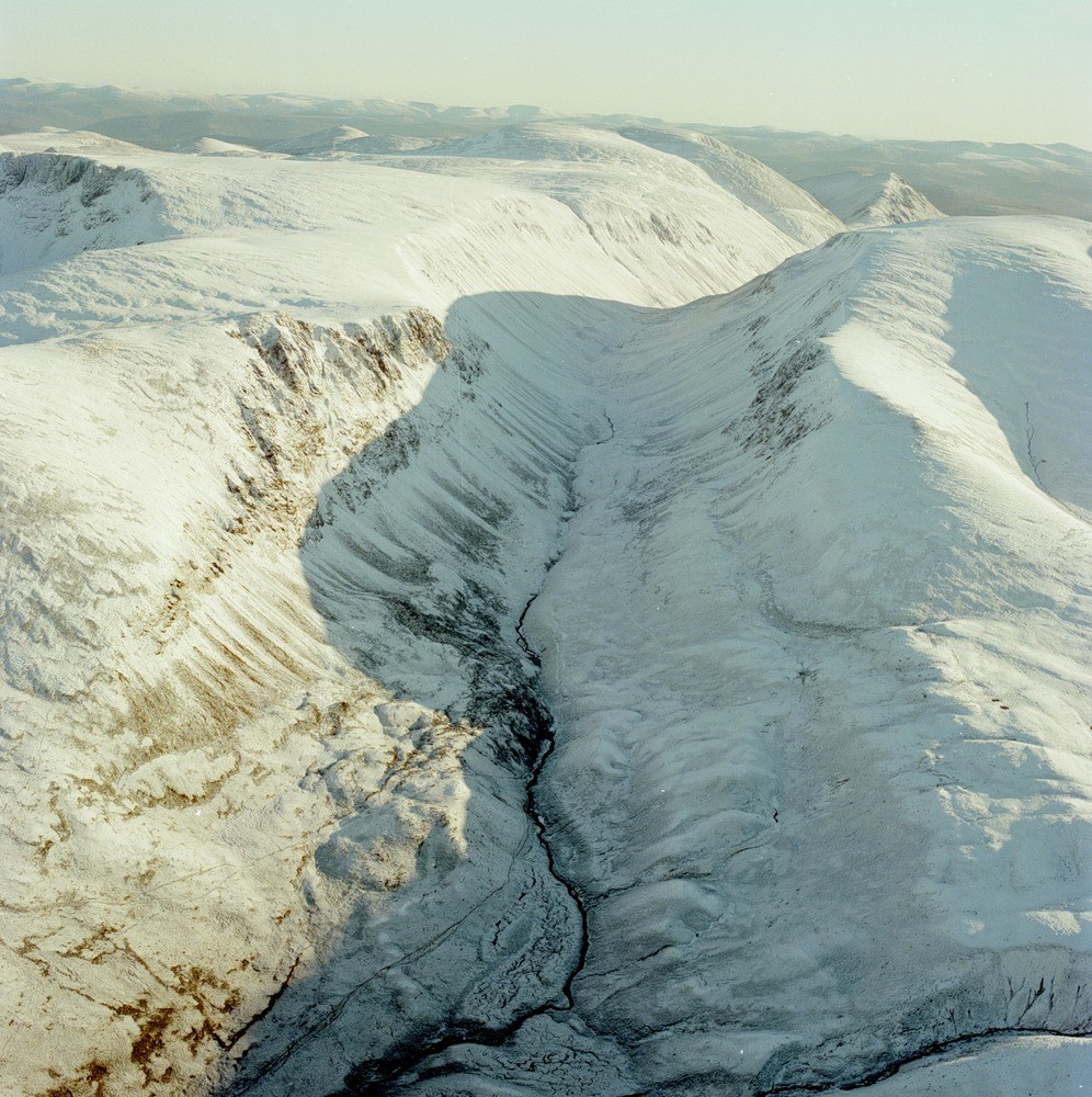
| Caption: | Oblique aerial view of Lairig Ghru from the north, Inverness-shire. This spectacular glacial trough is aligned north-south and forms a dramatic watershed breach between preglacial valleys. Lurchers Crag on the left. |
| Description: | Oblique aerial view of Lairig Ghru from the north, Inverness-shire. This spectacular glacial trough is aligned north-south and forms a dramatic watershed breach between preglacial valleys. Lurchers Crag on the left. This high-level glacial breach is 12 km. long, extending from Rothiemurchus Lodge at its northern end to Glen Geusachan at its southern end. It rises to 835 m. just near the Pools of Dee (near where the shadow crosses the valley bottom in the upper part of the photograph). The valley contains a spectacular rangle of talus-related periglacial and slope features. The Late-glacial talus slopes have been modified by Late-glacial and Holocene slope processes which include the formation of protalus ramparts, rock glaciers, debris flow, landslides and gullies. A particularly large rock glacier occurs on the left, below the scree slopes. |
| Photographer: | Unknown |
| Copyright statement: | NERC |
| Acknowledgment: | This image was digitized with grant-in-aid from SCRAN the Scottish Cultural Resources Access Network |
| X longitude/easting: | 296000 |
| Y latitude/northing: | 802000 |
| Coordinate reference system, ESPG code: | 27700 (OSGB 1936 / British National Grid) |
| Orientation: | Portrait |
| Size: | 341.99 KB; 996 x 1000 pixels; 84 x 85 mm (print at 300 DPI); 264 x 265 mm (screen at 96 DPI); |
| Average Rating: | Not yet rated |
| Categories: | Unsorted Images |
Loading...
Loading...
Reviews
There is currently no feedback