| P number: | P002921 |
|---|---|
| Old photograph number: | D05304 |
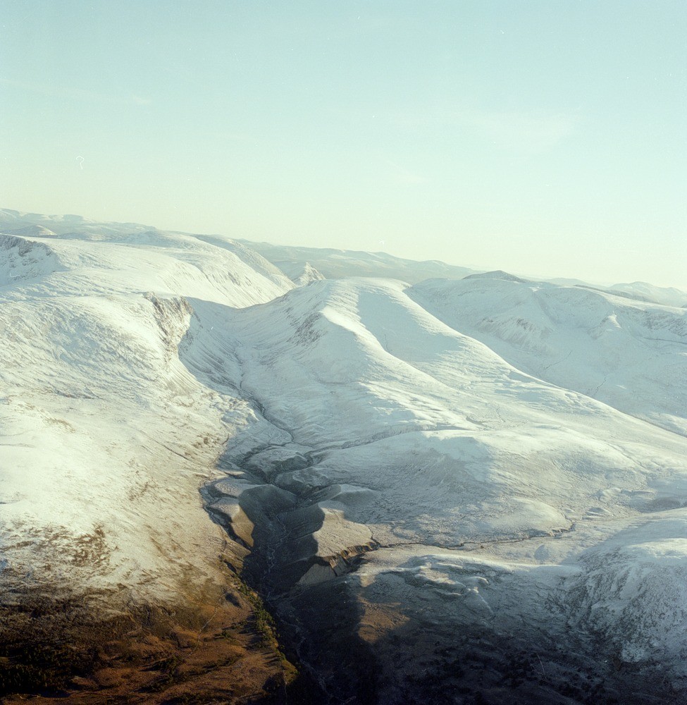
| Caption: | Oblique aerial view of Lairig Ghru from the north, Inverness-shire. The deeply carved glacial trough of the Lairig Ghru cutting through the pre-glacial plateau surfaces. |
| Description: | Oblique aerial view of Lairig Ghru from the north, Inverness-shire. The deeply carved glacial trough of the Lairig Ghru cutting through the pre-glacial plateau surfaces. During the last major glaciation powerful ice streams cut through the watershed to form this classic glacial breach. The prominent flat-topped terraces on both sides of the Allt Druidh just at the snowline are of deltaic origin. They formed in an ice-dammed lake between the Lairig Ghru glacier and the Glenmore lobe. At their south end they terminate with ice contact slopes and their surfaces slope both down valley and out towards the valley sides. There are multiple levels declining northward from the highest surface at 574 m., they indicate falling lake levels with the lake level stable for long periods at low elevation. As the lake level fell, contemporaneous fluvial erosion of the abandoned delta would have provided sediment for the lower deltas. The total thickness of sediment is c. 80 m. Ice-contact moraines can be seen as ridges in front/slightly right of the deltaic deposits. |
| Photographer: | Unknown |
| Copyright statement: | NERC |
| Acknowledgment: | This image was digitized with grant-in-aid from SCRAN the Scottish Cultural Resources Access Network |
| X longitude/easting: | 296000 |
| Y latitude/northing: | 803000 |
| Coordinate reference system, ESPG code: | 27700 (OSGB 1936 / British National Grid) |
| Orientation: | Portrait |
| Size: | 243.58 KB; 975 x 1000 pixels; 83 x 85 mm (print at 300 DPI); 258 x 265 mm (screen at 96 DPI); |
| Average Rating: | Not yet rated |
| Categories: | Unsorted Images |
Loading...
Loading...
Reviews
There is currently no feedback