| P number: | P002907 |
|---|---|
| Old photograph number: | D05279 |
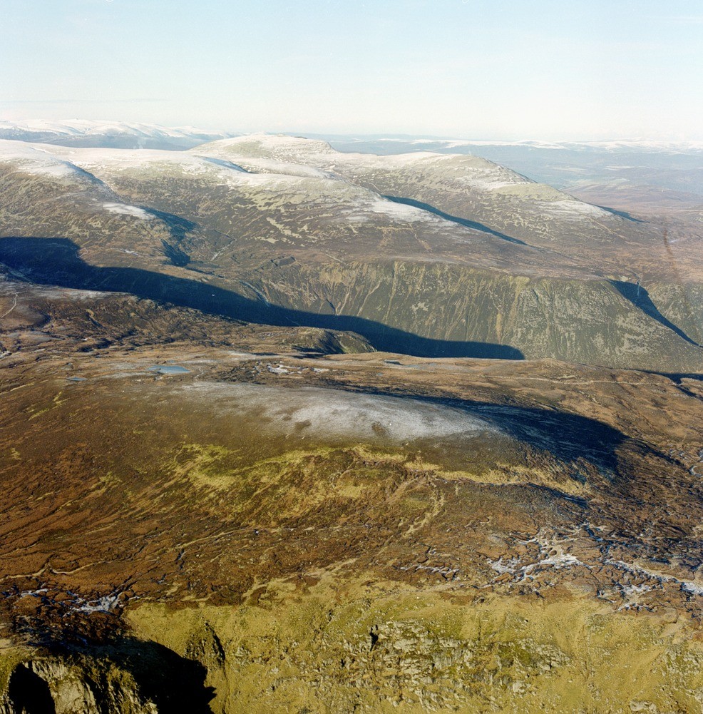
| Caption: | Oblique aerial view of Lochnagar from the south-east, Aberdeenshire. Dissected high level plateaux. A view north-westwards from above upper Glen Clova, across Glen Muick to the summit ridge of Lochnagar (1155 m.). |
| Description: | Oblique aerial view of Lochnagar from the south-east, Aberdeenshire. Dissected high level plateaux. A view north-westwards from above upper Glen Clova, across Glen Muick to the summit ridge of Lochnagar (1155 m.). Two distinct plateau surfaces can be seen; the lower at 700 m., cut in the middle distance by the deep trough of Glen Muick and a higher level (1040 m.) extending westwards from Lochnagar to encompass The Mounth. The bulk of the photographed area is underlain by granites of the Lochnagar intrusion, but the crags in the foreground comprise quartz-diorite of the Juanjorge body. The extensive area of wasting blanket peat on the plateau in the foreground is again very evident. |
| Photographer: | Unknown |
| Copyright statement: | NERC |
| Acknowledgment: | This image was digitized with grant-in-aid from SCRAN the Scottish Cultural Resources Access Network |
| X longitude/easting: | 326000 |
| Y latitude/northing: | 781000 |
| Coordinate reference system, ESPG code: | 27700 (OSGB 1936 / British National Grid) |
| Orientation: | Portrait |
| Size: | 378.37 KB; 986 x 1001 pixels; 83 x 85 mm (print at 300 DPI); 261 x 265 mm (screen at 96 DPI); |
| Average Rating: | Not yet rated |
| Categories: | Best of BGS Images/ Landscapes |
Loading...
Loading...
Reviews
There is currently no feedback