| P number: | P002902 |
|---|---|
| Old photograph number: | D05269 |
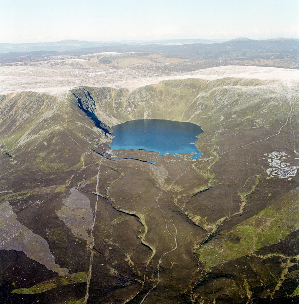
| Caption: | Oblique aerial view of Loch Brandy, Angus. High-level corrie, corrie lochan and the East Grampian Plateau. This is a closer view of the scene described in D05263 which better illustrates the morainic deposits at and below the corrie lip. |
| Description: | Oblique aerial view of Loch Brandy, Angus. High-level corrie, corrie lochan and the East Grampian Plateau. This is a closer view of the scene described in D05263 which better illustrates the morainic deposits at and below the corrie lip. The well-developed high-level corrie on the north-east side of Glen Clova on the edge of an 800 m. plateau is believed to represent, at least in part, a Devonian erosion surface. The surface of Loch Brandy is at 600 m. The corrie is cut in Dalradian pelites and psammites of the Longshank Gneiss Formation which are well exposed in the headwalls. Bedrock on the lower slopes is largely obscured by moraine and gravel. The pyramidal peak of Mount Keen seen in the right background is the highest point in the Mount Battock Granite. |
| Photographer: | Unknown |
| Copyright statement: | NERC |
| Acknowledgment: | This image was digitized with grant-in-aid from SCRAN the Scottish Cultural Resources Access Network |
| X longitude/easting: | 333000 |
| Y latitude/northing: | 775000 |
| Coordinate reference system, ESPG code: | 27700 (OSGB 1936 / British National Grid) |
| Orientation: | Portrait |
| Size: | 329.49 KB; 986 x 1001 pixels; 83 x 85 mm (print at 300 DPI); 261 x 265 mm (screen at 96 DPI); |
| Average Rating: | Not yet rated |
| Categories: | Best of BGS Images/ Landscapes |
Loading...
Loading...
Reviews
There is currently no feedback