| P number: | P002885 |
|---|---|
| Old photograph number: | D05243 |
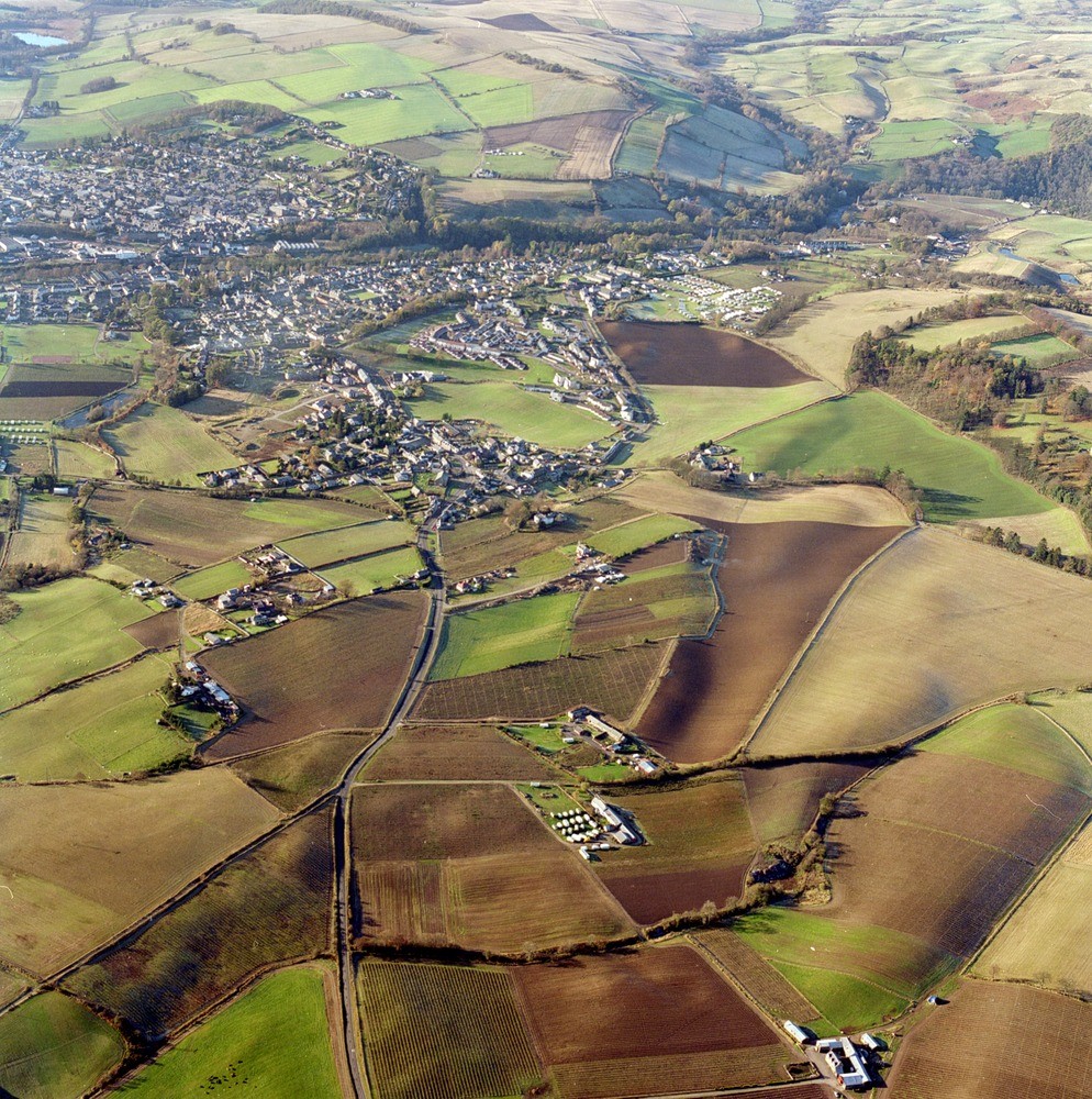
| Caption: | Oblique aerial view of Rattray and Blairgowrie, Perthshire. View westwards over Blairgowrie showing typical glaciated landscape on the edge of the Highlands. |
| Description: | Oblique aerial view of Rattray and Blairgowrie, Perthshire. View westwards over Blairgowrie showing typical glaciated landscape on the edge of the Highlands. Bedrock in the Blairgowrie area consists entirely of Lower Devonian fluviatile sedimentary rocks of the Arbuthnott and Garvoch Groups which become progressively older to the north. The immediate foreground is underlain by dull red sandstones of the Tannadice Formation, but the bulk of the succession below this comprises conglomerates of the Hatton and Craighall formations which form the higher ground to the north of the town. For the most part bedrock is concealed by blanket till, although a ribbon of glaciofluvial sand and gravel occupies the floor of the Ericht Valley which bisects Blairgowrie. There are a number of prominent glacial meltwater channels cutting the till in the foreground and on the higher ground to the north of the town. Rae and Marlee lochs, visible in the top right-hand corner of the photograph are kettle-hole lochs, which formed by the melting of masses of ice buried or enclosed by gravel. |
| Photographer: | Unknown |
| Copyright statement: | NERC |
| Acknowledgment: | This image was digitized with grant-in-aid from SCRAN the Scottish Cultural Resources Access Network |
| X longitude/easting: | 318000 |
| Y latitude/northing: | 745000 |
| Coordinate reference system, ESPG code: | 27700 (OSGB 1936 / British National Grid) |
| Orientation: | Portrait |
| Size: | 431.24 KB; 994 x 1000 pixels; 84 x 85 mm (print at 300 DPI); 263 x 265 mm (screen at 96 DPI); |
| Average Rating: | Not yet rated |
| Categories: | Best of BGS Images/ Landscapes |
Loading...
Loading...
Reviews
There is currently no feedback