| P number: | P002884 |
|---|---|
| Old photograph number: | D05240 |
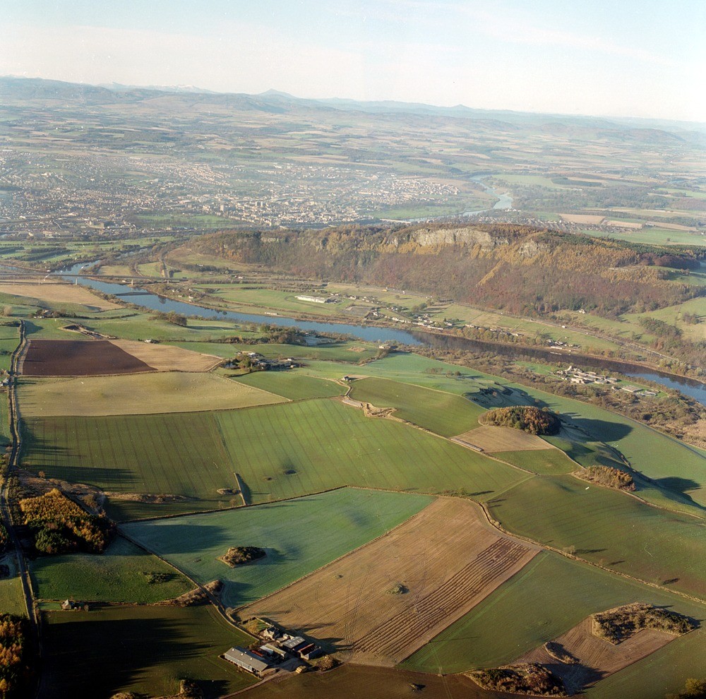
| Caption: | Oblique aerial view of the Perth area, north-westerly view over Perth and the River Tay illustrating the relationship between geology and topography. |
| Description: | Oblique aerial view of the Perth area, north-westerly view over Perth and the River Tay illustrating the relationship between geology and topography. The foreground and middle ground are largely composed of early Devonian lavas and volcanic conglomerate, which form the prominent crags on Kinnoull Hill. The lavas consist principally of basic pyroxene andesites but also include olivine and feldspathic bearing varieties. Perth and the lowlands beyond are underlain by Lower Devonian sandstone, conglomerates and rare mudstone formations. The line of the Highland Boundary Fault is clearly discernible in the distance beyond which the southern Highlands are formed of metasedimentary rocks of the late Precambrian Dalradian Supergroup. Peaks on the skyline include, from left to right, Ben Lawer range, Schiehallion and Farragon Hill. Bedrock in lowland Perthshire is largely concealed by till giving rise to the gently undulating ground visible in the foreground. Postglacial marine deposits occupy the north bank of the Tay to the east of Friarton Bridge. Moncrieffe Island immediately beyond the bridge is composed of alluvium. The low scarp feature to the south of the Tay, visible near the eastern edge of the photograph, is a former coastline; the low ground to the north is underlain by postglacial marine deposits, although the sewage works (the prominent group of buildings) is built on reclaimed tidal flats. |
| Photographer: | Unknown |
| Copyright statement: | NERC |
| Acknowledgment: | This image was digitized with grant-in-aid from SCRAN the Scottish Cultural Resources Access Network |
| X longitude/easting: | 314000 |
| Y latitude/northing: | 721000 |
| Coordinate reference system, ESPG code: | 27700 (OSGB 1936 / British National Grid) |
| Orientation: | Landscape |
| Size: | 317.19 KB; 1000 x 990 pixels; 85 x 84 mm (print at 300 DPI); 265 x 262 mm (screen at 96 DPI); |
| Average Rating: | Not yet rated |
| Categories: | Best of BGS Images/ Landscapes |
Loading...
Loading...
Reviews
There is currently no feedback