| P number: | P002846 |
|---|---|
| Old photograph number: | D02723 |
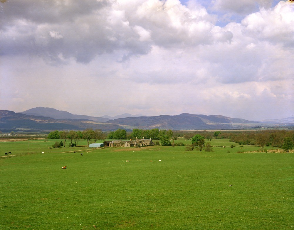
| Caption: | View of the Highland Border hills and fault scarp, from near Buchlyvie, Central Region. |
| Description: | View of the Highland Border hills and fault scarp, from near Buchlyvie, Central Region. Looking north to a distant view of the Menteith Hills which form the south-eastern limit of the Highlands in this area. The Highland Boundary Fault forms the fault scarp at the foot of these hills. The flat-lying area in the middle ground, beyond the farm, is Flanders Moss and the headwaters of the River Forth. All the flat ground between the photographer and the hills in the distance is part of the Midland Valley. Note the sharp difference in topography which largely determines the different agricultural potential of the two areas. In general, the Highlands have a thin poor soil suitable only for rough grazing or forestry. In contrast, the Midland Valley has large areas which are suitable for arable or dairy farming, as here. |
| Date taken: | Mon Jan 01 00:00:00 GMT 1979 |
| Photographer: | Christie, A. |
| Copyright statement: | NERC |
| Acknowledgment: | This image was digitized with grant-in-aid from SCRAN the Scottish Cultural Resources Access Network |
| X longitude/easting: | 254400 |
| Y latitude/northing: | 694000 |
| Coordinate reference system, ESPG code: | 27700 (OSGB 1936 / British National Grid) |
| Orientation: | Landscape |
| Size: | 196.81 KB; 1001 x 782 pixels; 85 x 66 mm (print at 300 DPI); 265 x 207 mm (screen at 96 DPI); |
| Average Rating: | Not yet rated |
| Categories: | Unsorted Images |
Loading...
Loading...
Reviews
There is currently no feedback