| P number: | P002832 |
|---|---|
| Old photograph number: | D02528 |
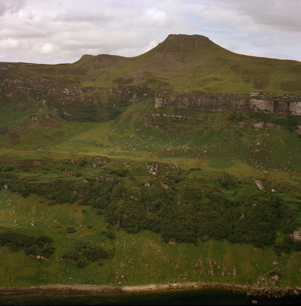
| Caption: | East coast of Raasay and Dun Caan, Highland Region. Tertiary igneous sill and lava flows overlying cliffs of Jurassic sediments. Landslipping in foreground. |
| Description: | East coast of Raasay and Dun Caan, Highland Region. Tertiary igneous sill and lava flows overlying cliffs of Jurassic sediments. Landslipping in foreground. The lavas are a remnant of an extensive and deeply eroded plateau of lavas that covered Skye and the Small Isles. The Jurassic sequence extends from the Great Estuarine Series below the summit of Dun Caan, the massive Inferior Oolite sandstone cliffs while below are the Upper Jurassic shales and Middle Lias Scalpa Sandstone. |
| Date taken: | Sat Jan 01 00:00:00 GMT 1977 |
| Photographer: | Christie, A. |
| Copyright statement: | NERC |
| Acknowledgment: | This image was digitized with grant-in-aid from SCRAN the Scottish Cultural Resources Access Network |
| X longitude/easting: | 161500 |
| Y latitude/northing: | 840500 |
| Coordinate reference system, ESPG code: | 27700 (OSGB 1936 / British National Grid) |
| Orientation: | Portrait |
| Size: | 285.09 KB; 985 x 1000 pixels; 83 x 85 mm (print at 300 DPI); 261 x 265 mm (screen at 96 DPI); |
| Average Rating: | Not yet rated |
| Categories: | Unsorted Images |
Loading...
Loading...
Reviews
There is currently no feedback