| P number: | P002830 |
|---|---|
| Old photograph number: | D02526 |
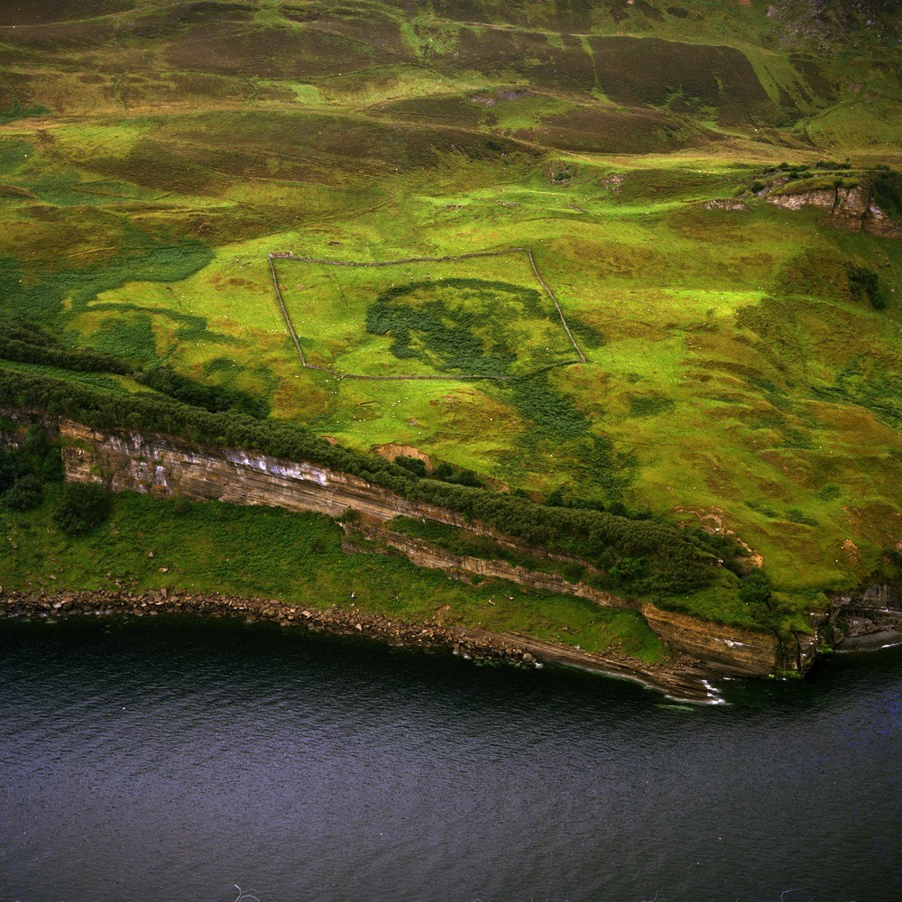
| Caption: | Oblique aerial view at Hallaig, Raasay, Highland Region. The Broadford Limestone (Lower Lias, Jurassic) forms the prominent cliff which runs down into the sea. The irregular surface behind the cliffs is partly covered with landslipped material. |
| Description: | Oblique aerial view at Hallaig, Raasay, Highland Region. The Broadford Limestone (Lower Lias, Jurassic) forms the prominent cliff which runs down into the sea. The irregular surface behind the cliffs is partly covered with landslipped material. In Raasay the Lower Lias strata are of marine origin of which calcareous sandstones and forms prominent scarps belongs to two main lithological divisions. The basal portion seen here, consists mainly of limestones and the overlying Pabba Shales (not seen). The rocks in the photograph dip to the north-west. |
| Date taken: | Sat Jan 01 00:00:00 GMT 1977 |
| Photographer: | Christie, A. |
| Copyright statement: | NERC |
| Acknowledgment: | This image was digitized with grant-in-aid from SCRAN the Scottish Cultural Resources Access Network |
| X longitude/easting: | 159500 |
| Y latitude/northing: | 838500 |
| Coordinate reference system, ESPG code: | 27700 (OSGB 1936 / British National Grid) |
| Orientation: | Square |
| Size: | 401.29 KB; 1000 x 1000 pixels; 85 x 85 mm (print at 300 DPI); 265 x 265 mm (screen at 96 DPI); |
| Average Rating: | Not yet rated |
| Categories: | Unsorted Images |
Loading...
Loading...
Reviews
There is currently no feedback