| P number: | P002817 |
|---|---|
| Old photograph number: | D02151 |
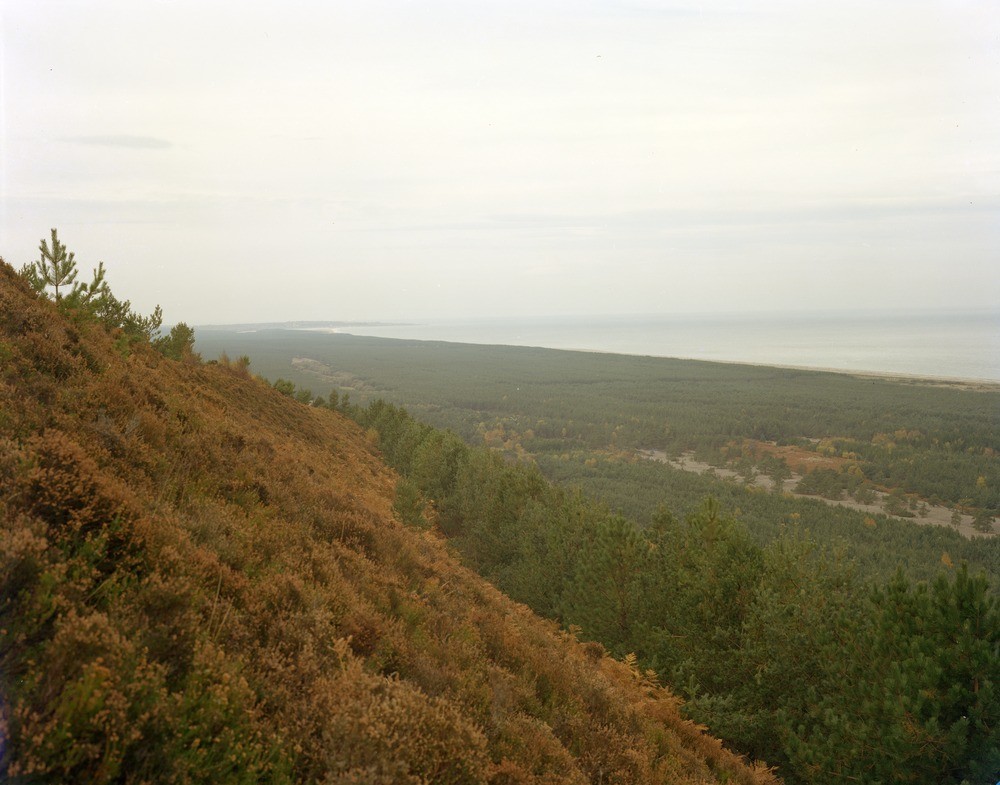
| Caption: | Binn Hill, between Garmouth and Lossiemouth, Moray. |
| Description: | From the mouth of the Spey westwards to Nether Unthank, the coast is backed by a belt of storm beaches - some 800-900 yards deep. They run parallel to a feature that in the vicinity of Binn Hill lies about 25 ft. O.D. The tidal drift which is responsible for the shingle ridges is still active today and is shown by the continuous tendency for a shingle spit to grow across the mouth of the Spey from Tugnet (several miles to the east). The materials forming the shingle ridges are of heterogeneous origin, about 70% are of Moine granulite and quartzite, vein quartz, feldspar porphyry and sandstone of Old Red Sandstone age are common. Late-glacial and postglacial raised beach deposits as viewed from Binn Hill looking north-east towards Lossiemouth over an ancient sea cliff. The ground in the foreground is underlain by glacial sand and gravel. |
| Date taken: | Sat Jan 01 00:00:00 GMT 1977 |
| Photographer: | Bennett, A. |
| Copyright statement: | NERC |
| Acknowledgment: | This image was digitized with grant-in-aid from SCRAN the Scottish Cultural Resources Access Network |
| X longitude/easting: | 330690 |
| Y latitude/northing: | 865900 |
| Coordinate reference system, ESPG code: | 27700 (OSGB 1936 / British National Grid) |
| Orientation: | Landscape |
| Size: | 177.88 KB; 1000 x 785 pixels; 85 x 66 mm (print at 300 DPI); 265 x 208 mm (screen at 96 DPI); |
| Average Rating: | Not yet rated |
| Categories: | Unsorted Images |
Loading...
Loading...
Reviews
There is currently no feedback