| P number: | P002780 |
|---|---|
| Old photograph number: | D01664 |
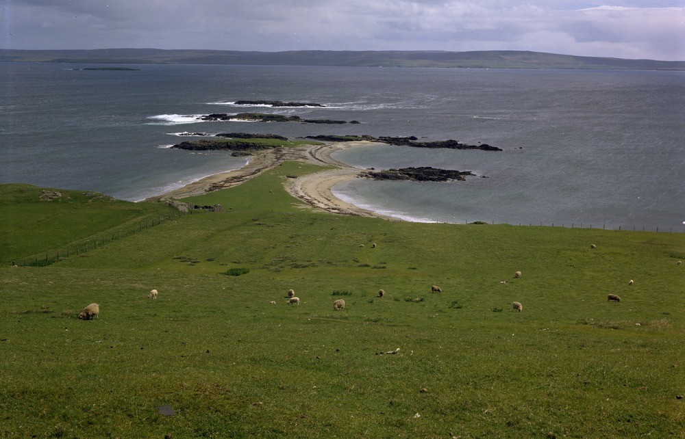
| Caption: | Long Taing, east coast of North Roe, Shetland Isles. A tombolo locally known as an ayre is seen linking offshore skerries to the mainland. The west coast of Yell is in the background across Yell Sound. |
| Description: | Long Taing, east coast of North Roe, Shetland Isles. A tombolo locally known as an ayre is seen linking offshore skerries to the mainland. The west coast of Yell is in the background across Yell Sound. It has been suggested that the Shetland Islands are the summits and upper slopes of a range of hills rising from the gently undulating plain of the North Sea floor some 122 metres below sea level. The present coastline of Shetland shows many features characteristic of recent submergence, the most obvious are the ria-like voes which are drowned drainage basins, of which Yell Sound and the voes running into it could be regarded as a classic example. The abundance of spits, bars and tombolos are also features of a submerged coast. |
| Date taken: | Mon Jan 01 00:00:00 GMT 1973 |
| Photographer: | Pulsford, J.M. |
| Copyright statement: | NERC |
| Acknowledgment: | This image was digitized with grant-in-aid from SCRAN the Scottish Cultural Resources Access Network |
| X longitude/easting: | 437500 |
| Y latitude/northing: | 1185400 |
| Coordinate reference system, ESPG code: | 27700 (OSGB 1936 / British National Grid) |
| Orientation: | Landscape |
| Size: | 201.09 KB; 1000 x 642 pixels; 85 x 54 mm (print at 300 DPI); 265 x 170 mm (screen at 96 DPI); |
| Average Rating: | Not yet rated |
| Categories: | Unsorted Images, Geoscience subjects/ Landforms, marine/ Coastal deposition, sand-bars, shingle-ridges, storm-beaches |
Loading...
Loading...
Reviews
There is currently no feedback