| P number: | P002779 |
|---|---|
| Old photograph number: | D01663 |
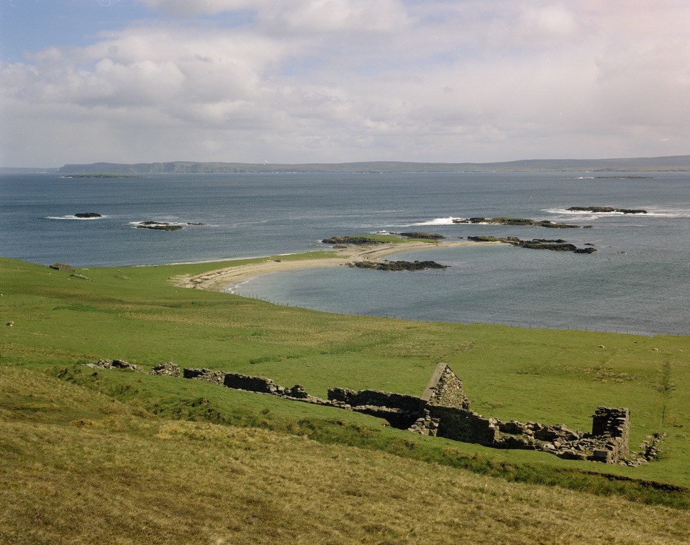
| Caption: | Long Taing, east coast of North Roe, Shetland Isles. A tombolo locally known as an ayre is seen linking offshore skerries to the mainland. The west coast of Yell is in the background across Yell Sound. |
| Description: | Long Taing, east coast of North Roe, Shetland Isles. A tombolo locally known as an ayre is seen linking offshore skerries to the mainland. The west coast of Yell is in the background across Yell Sound. The comparatively sheltered east coast of North Roe provides a low energy environment where marine deposition is prevalent. The formation of ayres by the deposition of sands and gravels is a feature of both emerging and submerging coastlines, though it is generally thought that the Shetland Islands are the result of submergence. |
| Date taken: | Mon Jan 01 00:00:00 GMT 1973 |
| Photographer: | Pulsford, J.M. |
| Copyright statement: | NERC |
| Acknowledgment: | This image was digitized with grant-in-aid from SCRAN the Scottish Cultural Resources Access Network |
| X longitude/easting: | 437400 |
| Y latitude/northing: | 1185300 |
| Coordinate reference system, ESPG code: | 27700 (OSGB 1936 / British National Grid) |
| Orientation: | Landscape |
| Size: | 216.92 KB; 1000 x 789 pixels; 85 x 67 mm (print at 300 DPI); 265 x 209 mm (screen at 96 DPI); |
| Average Rating: | Not yet rated |
| Categories: | Unsorted Images, Geoscience subjects/ Landforms, marine/ Coastal deposition, sand-bars, shingle-ridges, storm-beaches |
Loading...
Loading...
Reviews
There is currently no feedback