| P number: | P002750 |
|---|---|
| Old photograph number: | D01463 |
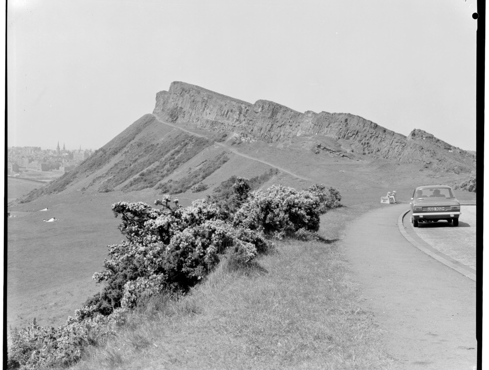
| Caption: | Salisbury Craigs from the Queen's Drive, Midlothian. Salisbury Craigs, the prominent feature in the middle distance are formed by a Lower Carboniferous teschenite sill intruded into strata of the Lower Carboniferous Cementstone Group. |
| Description: | Salisbury Craigs from the Queen's Drive, Midlothian. Salisbury Craigs, the prominent feature in the middle distance are formed by a Lower Carboniferous teschenite sill intruded into strata of the Lower Carboniferous Cementstone Group. Sediments immediately underlying the sill can be seen at several localities, but most of the steep slope under the sill on the left is scree-covered. The sill decreases in thickness towards the south-east (towards the right in the photograph). |
| Date taken: | Sun Jan 01 00:00:00 GMT 1967 |
| Photographer: | Christie, A. |
| Copyright statement: | NERC |
| Acknowledgment: | This image was digitized with grant-in-aid from SCRAN the Scottish Cultural Resources Access Network |
| X longitude/easting: | 327500 |
| Y latitude/northing: | 672500 |
| Coordinate reference system, ESPG code: | 27700 (OSGB 1936 / British National Grid) |
| Orientation: | Landscape |
| Size: | 182.32 KB; 1000 x 756 pixels; 85 x 64 mm (print at 300 DPI); 265 x 200 mm (screen at 96 DPI); |
| Average Rating: | Not yet rated |
| Categories: | Unsorted Images, Geoscience subjects/ Igneous features/ Sills |
Loading...
Loading...
Reviews
There is currently no feedback