| P number: | P002693 |
|---|---|
| Old photograph number: | D01069 |
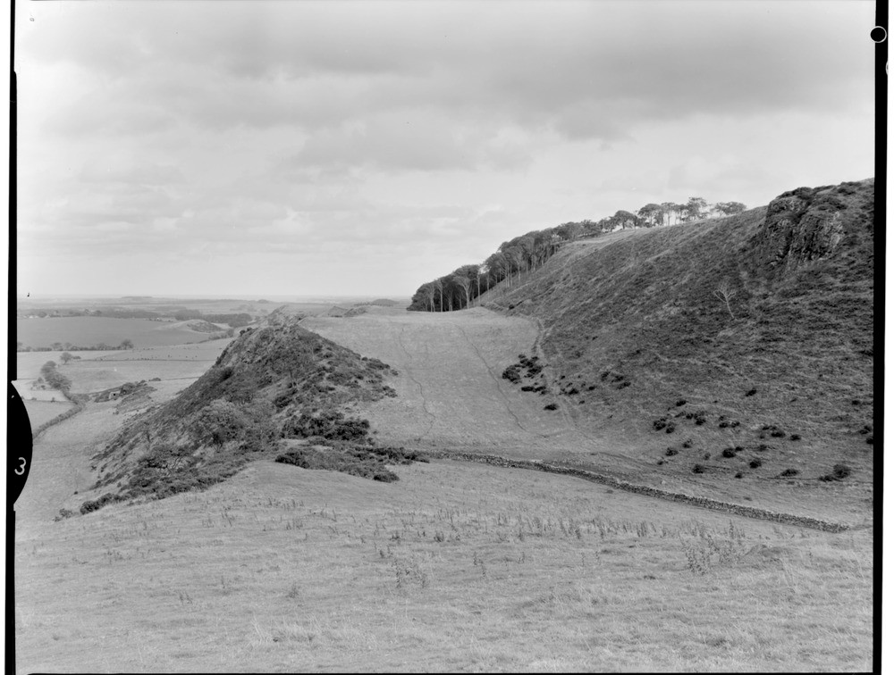
| Caption: | Garleton Hills, Kae Heughs, East Lothian. Looking east. |
| Description: | Garleton Hills, Kae Heughs, East Lothian. Looking east. Lower Carboniferous trachyte lava flows at the top of the Garleton Hills Volcanic Formation, Strathclyde Group. Here, on the north face of the Garleton Hills, they have been eroded to form a one-sided marginal glacial drainage channel. This would have been cut when the low ground on the left of the photograph was choked with stagnant ice filling the Firth of Forth. Drainage water would then have escaped around the south side of the ice sheet, between the ice and the rock wall, cutting this one-sided channel in the process. |
| Date taken: | Sun Jan 01 00:00:00 GMT 1967 |
| Photographer: | Christie, A. |
| Copyright statement: | NERC |
| Acknowledgment: | This image was digitized with grant-in-aid from SCRAN the Scottish Cultural Resources Access Network |
| X longitude/easting: | 351400 |
| Y latitude/northing: | 676400 |
| Coordinate reference system, ESPG code: | 27700 (OSGB 1936 / British National Grid) |
| Orientation: | Landscape |
| Size: | 173.54 KB; 1000 x 756 pixels; 85 x 64 mm (print at 300 DPI); 265 x 200 mm (screen at 96 DPI); |
| Average Rating: | Not yet rated |
| Categories: | Unsorted Images, Geoscience subjects/ Landforms, glaciation/ Overflow and marginal channels |
Loading...
Loading...
Reviews
There is currently no feedback