| P number: | P002660 |
|---|---|
| Old photograph number: | D00562 |
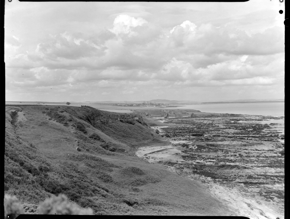
| Caption: | View from cliff top below Kingask, about 3.2 km. east of St. Andrews, Fife Region. |
| Description: | The coast here shows a variety of features. The sedimentary rocks of sandstones and shales deposited in shallow, freshwater or deltaic conditions contain many sedimentary structures such as cross-bedding, ripple marks and joints. The rocks show considerable folding and faulting. In the distance the Rock and Spindle is a stack formed from the remains of a Carboniferous volcanic vent. Beneath the old cliffs, now covered in vegetation is a small postglacial raised beach. Looking west at St. Andrews. Coastal view showing reefs, on shore, cliffs, Rock and Spindle and Lucklaw Hill (skyline behind St. Andrews). The rocks belong to the Strathclyde Group, Carboniferous Calciferous Sandstone Measures. |
| Date taken: | Tue Jan 01 00:00:00 GMT 1963 |
| Photographer: | Fisher, W.D. |
| Copyright statement: | Crown |
| Acknowledgment: | This image was digitized with grant-in-aid from SCRAN the Scottish Cultural Resources Access Network |
| X longitude/easting: | 354500 |
| Y latitude/northing: | 715500 |
| Coordinate reference system, ESPG code: | 27700 (OSGB 1936 / British National Grid) |
| Orientation: | Landscape |
| Size: | 175.98 KB; 1000 x 756 pixels; 85 x 64 mm (print at 300 DPI); 265 x 200 mm (screen at 96 DPI); |
| Average Rating: | Not yet rated |
| Categories: | Unsorted Images, Geoscience subjects/ Landforms, marine/ Marine platforms |
Loading...
Loading...
Reviews
There is currently no feedback