| P number: | P002642 |
|---|---|
| Old photograph number: | D00367 |
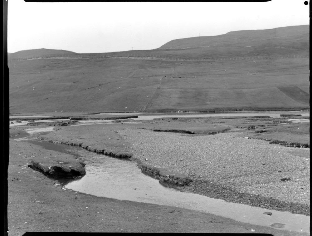
| Caption: | Bight of Haggrister, looking south, Mainland, Shetland Isles. 'Ayre' ponding a tidal lochan by which peat is being submerged and eroded. A close view of the streams and gravel banks behind the ayre. |
| Description: | Bight of Haggrister, looking south, Mainland, Shetland Isles. 'Ayre' ponding a tidal lochan by which peat is being submerged and eroded. A close view of the streams and gravel banks behind the ayre. Isostatic adjustment following deglaciation led to the emergence of much of Scotland and the formation of raised beaches, however peripheral areas including Shetland have been affected by submergence, a process which has been going on throughout the Holocene. Evidence for recent submergence occurs in sheltered places such as the Bight of Haggrister where a layer of peat crosses the present shoreline and can be found below sea level. Shingle forming a bay head barrier (known locally as an 'ayre') has been deposited on the peat and eroded remnants of peat can be seen in the lagoon on the landward side of the barrier. |
| Date taken: | Sun Jan 01 00:00:00 GMT 1961 |
| Photographer: | Fisher, W.D. |
| Copyright statement: | Crown |
| Acknowledgment: | This image was digitized with grant-in-aid from SCRAN the Scottish Cultural Resources Access Network |
| X longitude/easting: | 434500 |
| Y latitude/northing: | 1161500 |
| Coordinate reference system, ESPG code: | 27700 (OSGB 1936 / British National Grid) |
| Orientation: | Landscape |
| Size: | 174.86 KB; 1000 x 756 pixels; 85 x 64 mm (print at 300 DPI); 265 x 200 mm (screen at 96 DPI); |
| Average Rating: | Not yet rated |
| Categories: | Unsorted Images, Geoscience subjects/ Landforms, erosion |
Loading...
Loading...
Reviews
There is currently no feedback