| P number: | P002638 |
|---|---|
| Old photograph number: | D00359 |
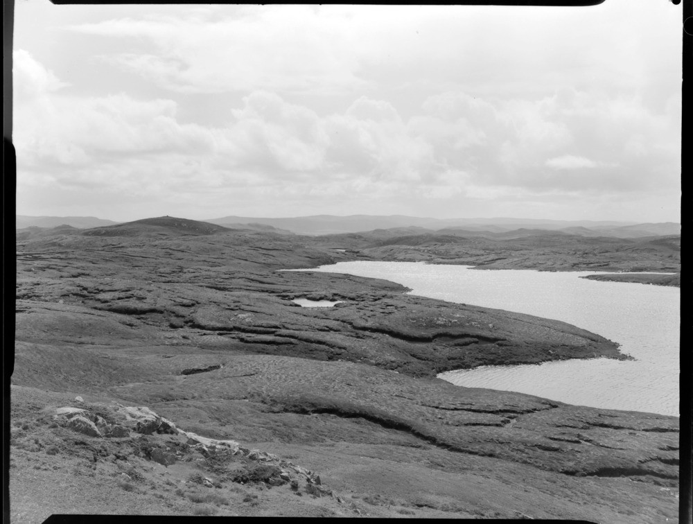
| Caption: | From Soolmis Vird, 1.2 km. south of Gunnister, Mainland, Shetland Isles. Knoll and loch topography of diorite country. |
| Description: | From Soolmis Vird, 1.2 km. south of Gunnister, Mainland, Shetland Isles. Knoll and loch topography of diorite country. The low rocky hills and water-filled hollows (knoll and loch topography) are typical of the country produced by glacial erosion of diorite during the Quaternary period. The diorite forms part of the Northmaven Complex which includes various types of granite, granophyre and gabbro as well as diorite. These igneous rocks were intruded into the metamorphic rocks of the area during a fairly prolonged period of magmatic activity in the Devonian period. The Northmaven Complex is classed as a post-orogenic complex of the Caledonian Orogeny. |
| Date taken: | Sun Jan 01 00:00:00 GMT 1961 |
| Photographer: | Fisher, W.D. |
| Copyright statement: | Crown |
| Acknowledgment: | This image was digitized with grant-in-aid from SCRAN the Scottish Cultural Resources Access Network |
| X longitude/easting: | 431500 |
| Y latitude/northing: | 1173500 |
| Coordinate reference system, ESPG code: | 27700 (OSGB 1936 / British National Grid) |
| Orientation: | Landscape |
| Size: | 156.34 KB; 1000 x 756 pixels; 85 x 64 mm (print at 300 DPI); 265 x 200 mm (screen at 96 DPI); |
| Average Rating: | Not yet rated |
| Categories: | Unsorted Images, Geoscience subjects/ General views/ Igneous rock country |
Loading...
Loading...
Reviews
There is currently no feedback