| P number: | P002614 |
|---|---|
| Old photograph number: | D00166 |
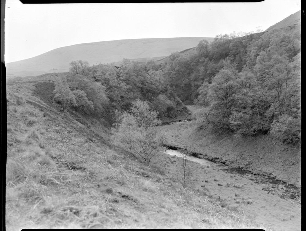
| Caption: | Incised meander in the Corriebeagh Burn, about 13 km. north-east of Callander, Perthshire. |
| Description: | Incised meander in the Corriebeagh Burn, about 13 km. north-east of Callander, Perthshire. Looking east-south-east along an incised meander. The local bedrock is volcaniclastic conglomerate and sandstone in the northern limb of the Strathmore Syncline. The north slope of Meall a' Choire Riabhaich can be seen on the right, and Cromlet (with peat hags on top) in the background. Occasionally, when watercourses cut down to a lower base level of erosion, a meander which had developed in alluvium on a flood plain can cut downwards and become incised into bedrock. The natural progression of the meander is thus ended, preserving the sinuous shape of the stream just before incision. |
| Date taken: | Thu Jan 01 00:00:00 GMT 1959 |
| Photographer: | Fisher, W.D. |
| Copyright statement: | Crown |
| Acknowledgment: | This image was digitized with grant-in-aid from SCRAN the Scottish Cultural Resources Access Network |
| X longitude/easting: | 275500 |
| Y latitude/northing: | 713500 |
| Coordinate reference system, ESPG code: | 27700 (OSGB 1936 / British National Grid) |
| Orientation: | Landscape |
| Size: | 204.16 KB; 1000 x 756 pixels; 85 x 64 mm (print at 300 DPI); 265 x 200 mm (screen at 96 DPI); |
| Average Rating: | Not yet rated |
| Categories: | Unsorted Images, Geoscience subjects/ Landforms, river/ Incised meanders |
Loading...
Loading...
Reviews
There is currently no feedback