| P number: | P002588 |
|---|---|
| Old photograph number: | D00028 |
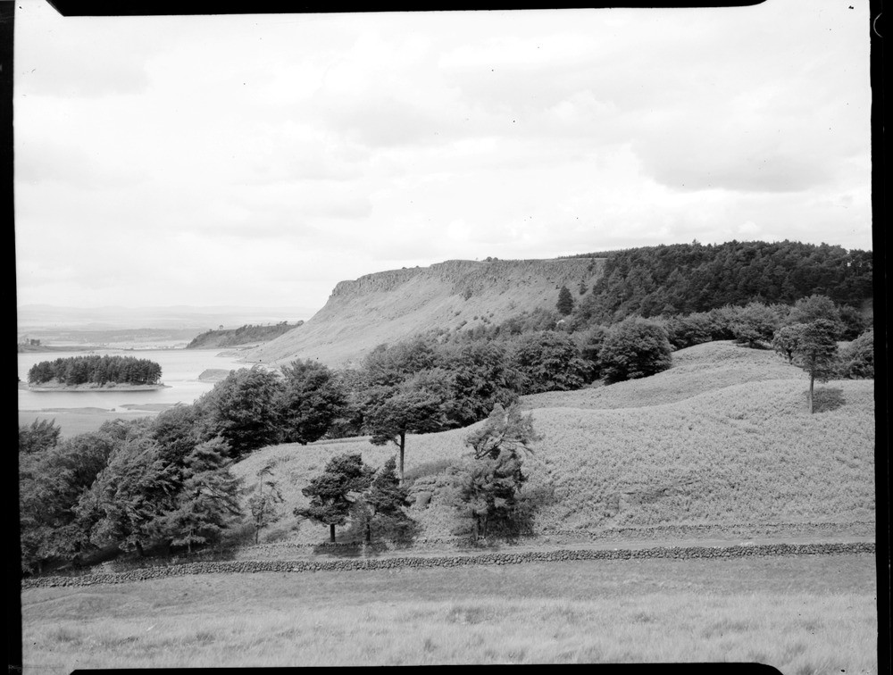
| Caption: | Looking north-eastwards along the top of the quartz-dolerite escarpment in Craigs Wood to where the dolerite rises abruptly through the succession and forms the top of Sauchie Craigs. |
| Description: | Sauchie Craigs is part of the Stirling Sill, a transgressive sill complex of over 300 ft. thick. The various levels of the sill have been intruded into a range of Carboniferous rocks, here at Sauchie Craigs it is intruded into the Dinantian Lower Limestone Group. This particular section is located between the northerly Wallstale Fault and the southerly Auchenbowie Fault. The faults have acted as dyke-like feeders to different levels of the sill. Photograph taken from 457 m. east-south-east of Todholes, Stirlingshire. |
| Date taken: | Sun Jan 01 00:00:00 GMT 1956 |
| Photographer: | Fisher, W.D. |
| Copyright statement: | Crown |
| Acknowledgment: | This image was digitized with grant-in-aid from SCRAN the Scottish Cultural Resources Access Network |
| Orientation: | Landscape |
| Size: | 182.87 KB; 1000 x 756 pixels; 85 x 64 mm (print at 300 DPI); 265 x 200 mm (screen at 96 DPI); |
| Average Rating: | Not yet rated |
| Categories: | Unsorted Images |
Loading...
Loading...
Reviews
There is currently no feedback