| P number: | P002582 |
|---|---|
| Old photograph number: | D00011 |
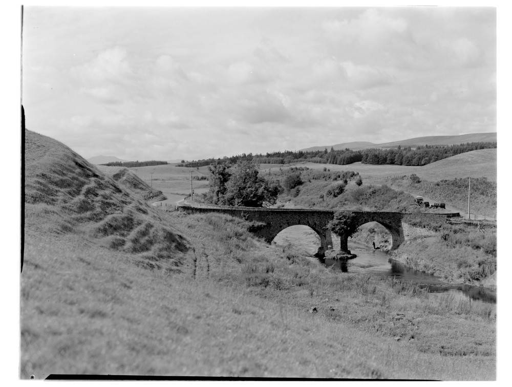
| Caption: | Allan Water, 0.4 km. north of Kinbuck, Perthshire. North end of area of glacial/fluvioglacial sands and gravels. |
| Description: | Allan Water, 0.4 km. north of Kinbuck, Perthshire. North end of area of glacial/fluvioglacial sands and gravels. The Allan Water cuts a channel between large transverse gravel mounds at least 60 ft. high (left and right). Sandstone of Lower Old Red Sandstone age forms foundations for bridge. |
| Date taken: | Sun Jan 01 00:00:00 GMT 1956 |
| Photographer: | Fisher, W.D. |
| Copyright statement: | Crown |
| Acknowledgment: | This image was digitized with grant-in-aid from SCRAN the Scottish Cultural Resources Access Network |
| X longitude/easting: | 279500 |
| Y latitude/northing: | 705500 |
| Coordinate reference system, ESPG code: | 27700 (OSGB 1936 / British National Grid) |
| Orientation: | Landscape |
| Size: | 158.11 KB; 1000 x 756 pixels; 85 x 64 mm (print at 300 DPI); 265 x 200 mm (screen at 96 DPI); |
| Average Rating: | Not yet rated |
| Categories: | Unsorted Images |
Loading...
Loading...
Reviews
There is currently no feedback