| P number: | P002580 |
|---|---|
| Old photograph number: | C04218 |
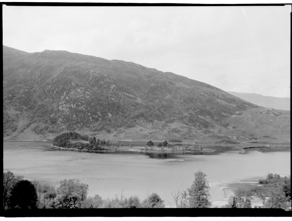
| Caption: | View of Loch Shiel and Callop Hills, from the Glenfinnan War Memorial (451 m. west 30 degrees north of Prince Charlie's Monument), Inverness-shire. |
| Description: | Meall a' Bhainne opposite is composed of metamorphic rocks of the Glenfinnan Division of the Precambrian Moine series. The rocks were originally deposited in shallow water as sandstones but have been subsequently folded and metamorphosed mainly during the Caledonian Orogeny, a phase of mountain building to form the psammites (quartz-feldspar granulites). The flat area on which the monument stands (C04217) is an alluvial flat. Loch Shiel itself is a 'finger' or 'ribbon' lake in a glacially deepened hollow developed along a north-east - south-west shatter belt. It is 17.5 miles long but at no point is it more than one mile wide. The Callop gap, the wide open valley to the left, (C04217) is a major through valley that breaches the main north-south watershed. Hills of psammitic granulite with granite pegmatite net-vein complex. Part of a panorama, with C04218, C04219. The description is for the whole panorama. |
| Date taken: | Fri Jan 01 00:00:00 GMT 1954 |
| Photographer: | Fisher, W.D. |
| Copyright statement: | Crown |
| Acknowledgment: | This image was digitized with grant-in-aid from SCRAN the Scottish Cultural Resources Access Network |
| X longitude/easting: | 190500 |
| Y latitude/northing: | 780500 |
| Coordinate reference system, ESPG code: | 27700 (OSGB 1936 / British National Grid) |
| Orientation: | Landscape |
| Size: | 144.06 KB; 1000 x 756 pixels; 85 x 64 mm (print at 300 DPI); 265 x 200 mm (screen at 96 DPI); |
| Average Rating: | Not yet rated |
| Categories: | Unsorted Images |
Loading...
Loading...
Reviews
There is currently no feedback