| P number: | P002563 |
|---|---|
| Old photograph number: | C04104 |
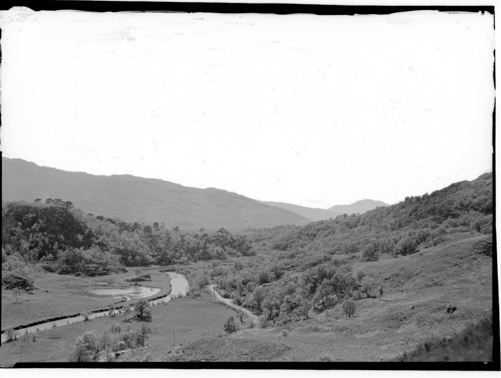
| Caption: | The Callop Gap (from the west, 274 m. east of Prince Charles's Monument Glenfinnan) Inverness-shire. A low col on the east-west 'through valley' that extends from Arisaig on the western seaboard to Loch Eil and the head of Loch Linnhe. |
| Description: | The Callop Gap (from the west, 274 m. east of Prince Charles's Monument Glenfinnan) Inverness-shire. A low col on the east-west 'through valley' that extends from Arisaig on the western seaboard to Loch Eil and the head of Loch Linnhe. The alluvial floor of the defile is not more than 6.1 m. above O.D. Prior to the Quaternary Era the dominant drainage pattern was on a planated surface and to the east. Subsequent glaciations have modified this pattern to give the present system with main east-west through valleys with breached watersheds. Westward from the Callop Gap the drainage is via Loch Shiel to the west coast, east of the gap, drainage is eastwards via Loch Eil. |
| Date taken: | Fri Jan 01 00:00:00 GMT 1954 |
| Photographer: | Fisher, W.D. |
| Copyright statement: | Crown |
| Acknowledgment: | This image was digitized with grant-in-aid from SCRAN the Scottish Cultural Resources Access Network |
| X longitude/easting: | 190500 |
| Y latitude/northing: | 780500 |
| Coordinate reference system, ESPG code: | 27700 (OSGB 1936 / British National Grid) |
| Orientation: | Landscape |
| Size: | 142.71 KB; 1000 x 756 pixels; 85 x 64 mm (print at 300 DPI); 265 x 200 mm (screen at 96 DPI); |
| Average Rating: | Not yet rated |
| Categories: | Unsorted Images |
Loading...
Loading...
Reviews
There is currently no feedback