| P number: | P002556 |
|---|---|
| Old photograph number: | C04028 |
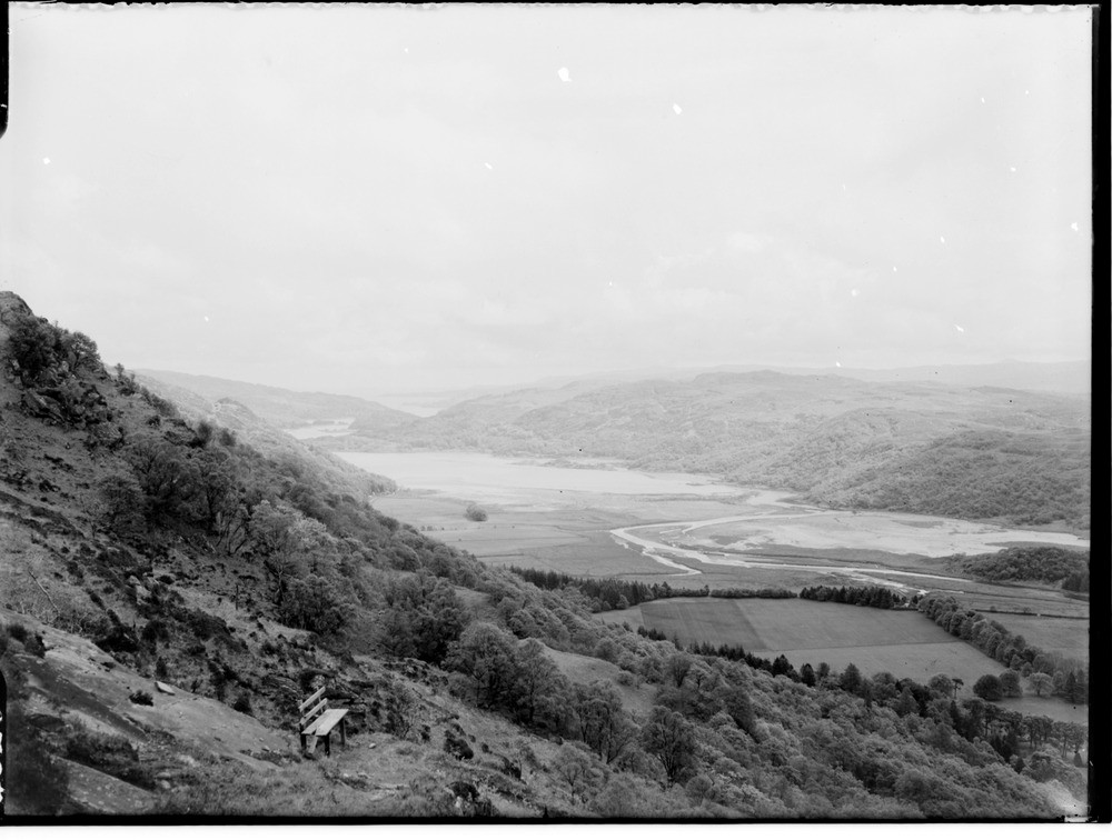
| Caption: | Upper reaches of Loch Moidart, looking west-south-west from the path leading to Loch nam Paitean, Inverness-shire. |
| Description: | Upper reaches of Loch Moidart, looking west-south-west from the path leading to Loch nam Paitean, Inverness-shire. Alluvial flats occur where the River Moidart enters the head of the loch. The rocks are Moine schists. Eilean Shona on right in distance. In general, the Moine rocks comprise a limited series of lithological types, representing a metamorphosed series of arenaceous and argillaceous sediments, psammites and pelites respectively. The present mineral composition and condition of the rocks depends on their metamorphic grade and the extent to which they have been migmatized. |
| Date taken: | Sat Jan 01 00:00:00 GMT 1949 |
| Photographer: | Fisher, W.D. |
| Copyright statement: | Crown |
| Acknowledgment: | This image was digitized with grant-in-aid from SCRAN the Scottish Cultural Resources Access Network |
| X longitude/easting: | 172500 |
| Y latitude/northing: | 773500 |
| Coordinate reference system, ESPG code: | 27700 (OSGB 1936 / British National Grid) |
| Orientation: | Landscape |
| Size: | 155.19 KB; 1000 x 756 pixels; 85 x 64 mm (print at 300 DPI); 265 x 200 mm (screen at 96 DPI); |
| Average Rating: | Not yet rated |
| Categories: | Unsorted Images |
Loading...
Loading...
Reviews
There is currently no feedback