| P number: | P002555 |
|---|---|
| Old photograph number: | C04027 |
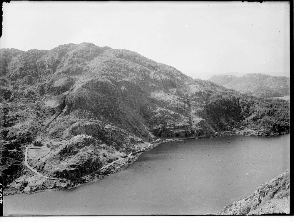
| Caption: | Eilean Shona, Loch Moidart looking southwards from Smirisary Hill, Inverness-shire. Moine pelites and psammites. |
| Description: | Eilean Shona, Loch Moidart looking southwards from Smirisary Hill, Inverness-shire. Moine pelites and psammites. From the school building on the right (594 m. east of Baramore) a 6.1 m. north 15 degrees west dolerite dyke lies in a hollow running obliquely uphill, towards the left, almost along a steep junction between (a) pelitic Moine schists forming craggy ground on the right (west) skyline, and (b) flaggy psammitic Moine schists, with a steep easterly dip, forming smoother skyline falling towards the left (east). Steep parallel joints with a trend about east - west, characteristic of the district, are clearly seen in the psammitic rocks. The 'slack' running uphill from the bay on the left is due to a fault. |
| Date taken: | Sat Jan 01 00:00:00 GMT 1949 |
| Photographer: | Fisher, W.D. |
| Copyright statement: | Crown |
| Acknowledgment: | This image was digitized with grant-in-aid from SCRAN the Scottish Cultural Resources Access Network |
| X longitude/easting: | 164500 |
| Y latitude/northing: | 775500 |
| Coordinate reference system, ESPG code: | 27700 (OSGB 1936 / British National Grid) |
| Orientation: | Landscape |
| Size: | 193.13 KB; 1000 x 756 pixels; 85 x 64 mm (print at 300 DPI); 265 x 200 mm (screen at 96 DPI); |
| Average Rating: | Not yet rated |
| Categories: | Unsorted Images |
Loading...
Loading...
Reviews
There is currently no feedback