| P number: | P002548 |
|---|---|
| Old photograph number: | C03944 |
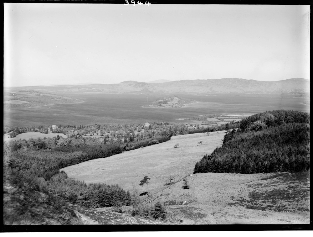
| Caption: | View north-eastwards across Loch Lomond from hillside south-west of Arden, Dumbarton. The Highland Boundary Fracture Zone, the area in the vicinity of the Highland Boundary Fault. |
| Description: | View north-eastwards across Loch Lomond from hillside south-west of Arden, Dumbarton. The Highland Boundary Fracture Zone, the area in the vicinity of the Highland Boundary Fault. The Highland Boundary Fault defines the contact of the Grampian Highlands and the Midland Valley graben (rift valley) to the south-east. It appears to have had a long and complex history. The centre of the island (Inchmurrin) and ridge (above Balmaha) in background are formed of carbonated serpentine in the Highland Boundary Fracture Zone. Foreground slopes and right background in Lower Old Red Sandstone south-east of the Fracture Zone. The left background is mainly in Upper Old Red Sandstone resting directly on Dalradian rocks, north-west of the Fracture Zone. The delta of the River Fruin can be seen left of centre. |
| Date taken: | Sat May 01 00:00:00 BST 1948 |
| Photographer: | Fisher, W.D. |
| Copyright statement: | Crown |
| Acknowledgment: | This image was digitized with grant-in-aid from SCRAN the Scottish Cultural Resources Access Network |
| X longitude/easting: | 235500 |
| Y latitude/northing: | 684500 |
| Coordinate reference system, ESPG code: | 27700 (OSGB 1936 / British National Grid) |
| Orientation: | Landscape |
| Size: | 175.14 KB; 1000 x 756 pixels; 85 x 64 mm (print at 300 DPI); 265 x 200 mm (screen at 96 DPI); |
| Average Rating: | Not yet rated |
| Categories: | Unsorted Images |
Loading...
Loading...
Reviews
There is currently no feedback