| P number: | P002547 |
|---|---|
| Old photograph number: | C03938 |
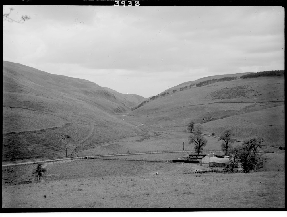
| Caption: | South Queich gorge, from Coulsknowe, Fifeshire. |
| Description: | South Queich gorge, from Coulsknowe, Fifeshire. View looking south-east down the gorge of the South Queich River, excavated along the brecciated rock on the line of a fault. Towards the end of the last glaciation, the valley served as an overflow channel for the waters of a lake impounded in the Glenday Valley to the right of the photograph. Such overflow valleys are common in recently glaciated terranes and indicate the former presence of a drainage pattern unrelated to modern topography. This was due to the natural drainage being restricted by the presence of large masses of stagnant and wasting ice occupying the low ground through which drainage would normally have flowed. |
| Date taken: | Sun Jun 01 00:00:00 BST 1947 |
| Photographer: | Fisher, W.D. |
| Copyright statement: | Crown |
| Acknowledgment: | This image was digitized with grant-in-aid from SCRAN the Scottish Cultural Resources Access Network |
| Orientation: | Landscape |
| Size: | 147.71 KB; 1000 x 756 pixels; 85 x 64 mm (print at 300 DPI); 265 x 200 mm (screen at 96 DPI); |
| Average Rating: | Not yet rated |
| Categories: | Unsorted Images, Geoscience subjects/ Landforms, river/ Valleys controlled by faults and shatter belts |
Loading...
Loading...
Reviews
There is currently no feedback