| P number: | P002544 |
|---|---|
| Old photograph number: | C03914 |
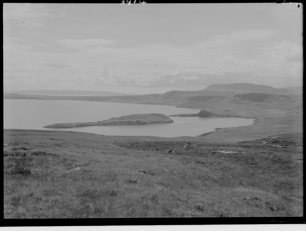
| Caption: | The north end of the Trotternish basalt plateau, looking south from Meall Tuath, Rubha Hunish, Skye, Inverness-shire. |
| Description: | Three levels of raised beach have been identified in this vicinity corresponding to the '100 ft.', '50 ft.' and '25 ft.' though the actual levels vary from these heights. The low hill Cnoc Roll just south of Duntulm Castle is a well-known example of a rockfall formed from a columnar basalt sill resting on Jurassic Great Estuarine sandstones and shales. In the distance are the higher hills and landslip scarps of the plateau basalt lavas of Sron Voulinn and Sgurr Mor. At the time of the photograph it was reported that the fall was still active, frequently disrupting the Uig-Kilmaluag road. The northern escarpment of Tertiary lavas, with Jurassic sediments and associated intrusive dolerite sills. Tulm Island on the right is formed of a dolerite sill. Part of a panorama with C03913. Description is for the full panorama. |
| Date taken: | Mon Jan 01 00:00:00 BST 1945 |
| Photographer: | Fisher, W.D. |
| Copyright statement: | Crown |
| Acknowledgment: | This image was digitized with grant-in-aid from SCRAN the Scottish Cultural Resources Access Network |
| X longitude/easting: | 141500 |
| Y latitude/northing: | 875500 |
| Coordinate reference system, ESPG code: | 27700 (OSGB 1936 / British National Grid) |
| Orientation: | Landscape |
| Size: | 109.03 KB; 1000 x 756 pixels; 85 x 64 mm (print at 300 DPI); 265 x 200 mm (screen at 96 DPI); |
| Average Rating: | Not yet rated |
| Categories: | Unsorted Images |
Loading...
Loading...
Reviews
There is currently no feedback